Cof Cymru: National Historic Assets of Wales · Wales
Capel Ainon
Llanuwchllyn, Gwynedd, Wales
A Grade II* listed building in Llanuwchllyn, Bala, Gwynedd, designated on 20 October 1966.
The record
- Designation
- Listed building, Grade II*
- Broad class
- Religious, Ritual and Funerary
- Date of designation
- 20 October 1966
- Locality
- Llanuwchllyn
- Town
- Bala
- Community
- Llanuwchllyn
- Unitary authority
- Gwynedd
- Country
- Wales
- Coordinates
- 52.85356, -3.67964
- Cadw reference
- 4679
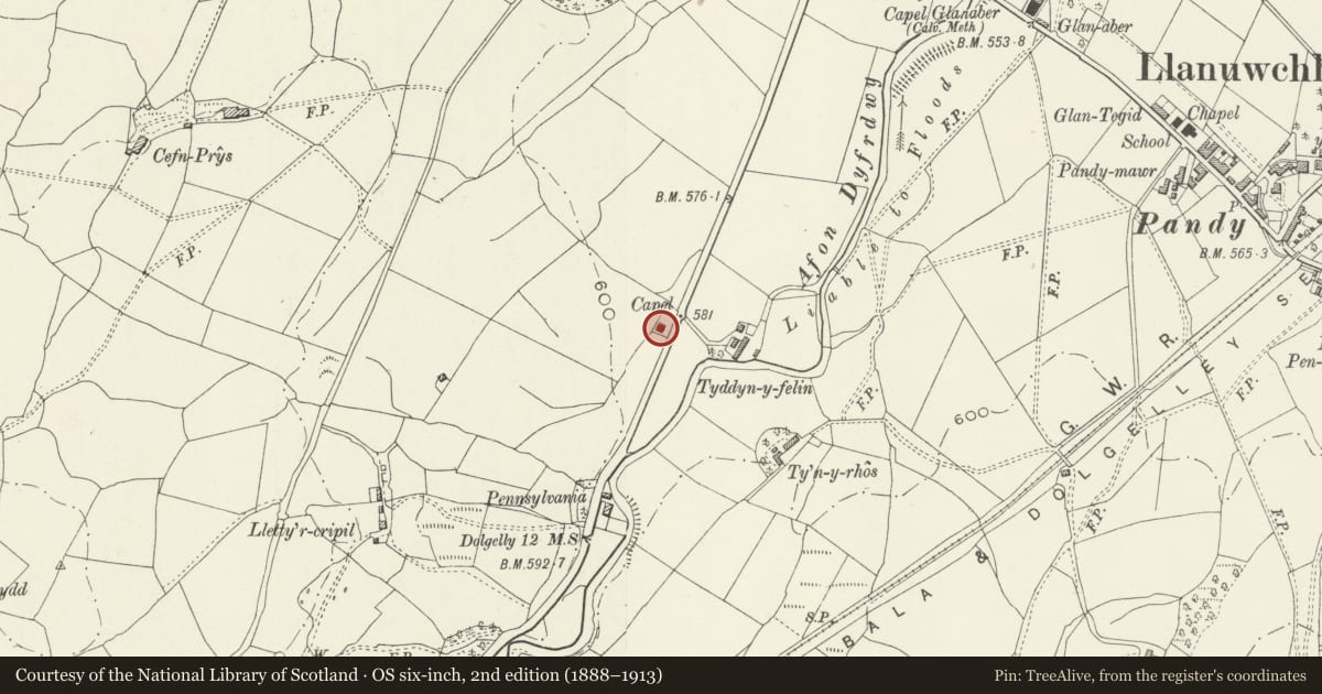
Slide toward Today to fade the historical sheet and see the modern map underneath.
David Rumsey Map Collection, Stanford LibrariesDavid Rumsey Map Collection, Stanford LibrariesLlyfrgell Genedlaethol Cymru – The National Library of WalesDavid Rumsey Map Collection, Stanford LibrariesDavid Rumsey Map Collection, Stanford Libraries
5 historical maps cover this location, the earliest the 1795 map "To Sir Watkin Williams-Wynn Bart ... the map of the six counties of North Wales is most humbly inscribed by his obedient humble servant" (Llyfrgell Genedlaethol Cymru – The National Library of Wales).
Historical maps covering this location
- 1795 · To Sir Watkin Williams-Wynn Bart ... the map of the six counties of North Wales is most… (Llyfrgell Genedlaethol Cymru – The National Library of Wales)
- 1830 · V.3:11-15:XV. Britisches Reich. A. Kon: England. b. Frstenthum Wales: Shire: 37-40 (David Rumsey Map Collection, Stanford Libraries)
- 1883 · Watershed map England, Wales 3. (David Rumsey Map Collection, Stanford Libraries)
- 1899 · 136 Bala (Hills) (David Rumsey Map Collection, Stanford Libraries)
- 1901 · Sheet 9 and 10. (David Rumsey Map Collection, Stanford Libraries)
Cadw's description
Location
Located approximately 1km SW of Llanuwchllyn village, set back slightly from the road within its own low-walled graveyard.
History
Baptist chapel dated 1840.
Exterior
Rectangular single-storey chapel of long wall entry type in vernacular Georgian style; of squared, rough-dressed stone blocks under a wide slate roof with oversailing eaves and verges. Symmetrical facade with central pair of 12-pane, unhorned sash windows flanking a square inset slate plaque inscribed: 'Ainon Addoldy Bedyddwyr 1840 Baptist Chapel.' Outer entrances (L and R) with boarded doors in pegged and moulded frames. The rear has three evenly-spaced, similar sashes, with applied horns and rough slate sills. Ashlar joints scratched onto slobbered mortar of gable end.
Interior
The interior is plain but largely unaltered. Boarded inner wind porches with wooden hat hooks to R and L. Flat plaster ceiling with 2 lateral plastered beams. There are 3 rows of raked box pews each to the back and front, with 3 rows of plain, open-backed pews at the front; pine joinery throughout. Central square panelled pulpit with canted sides and moulded cornice; steps up with wooden rail, columnar newel and stick balusters. The pulpit has a plain 4-panelled back with segmentally-arched top. To the L of the pulpit are 3 further box pews.
Reason for designation
Listed Grade II* as a particularly well-preserved, dated mid-C19 baptist chapel retaining largely unaltered exterior and interior character.
Nearby in the register
- Prys MawrDomesticunder 1 mi
- EnlliDomesticunder 1 mi
- Trem WawrDomesticunder 1 mi
- Lychgate at the Parish Church of St Deiniol, including walls and railings to churchyardReligious, Ritual and Funeraryunder 1 mi
Other entries of the same register within about three miles of this one, by straight line.