Cof Cymru: National Historic Assets of Wales · Wales
Pont y Bala (partly in Bala community)
Llandderfel, Gwynedd, Wales
A Grade II listed building in Bala, Llandderfel, Gwynedd, designated on 6 December 1951.
The record
- Designation
- Listed building, Grade II
- Broad class
- Transport
- Date of designation
- 6 December 1951
- Town
- Bala
- Community
- Llandderfel
- Unitary authority
- Gwynedd
- Country
- Wales
- Coordinates
- 52.91327, -3.59328
- Cadw reference
- 4653
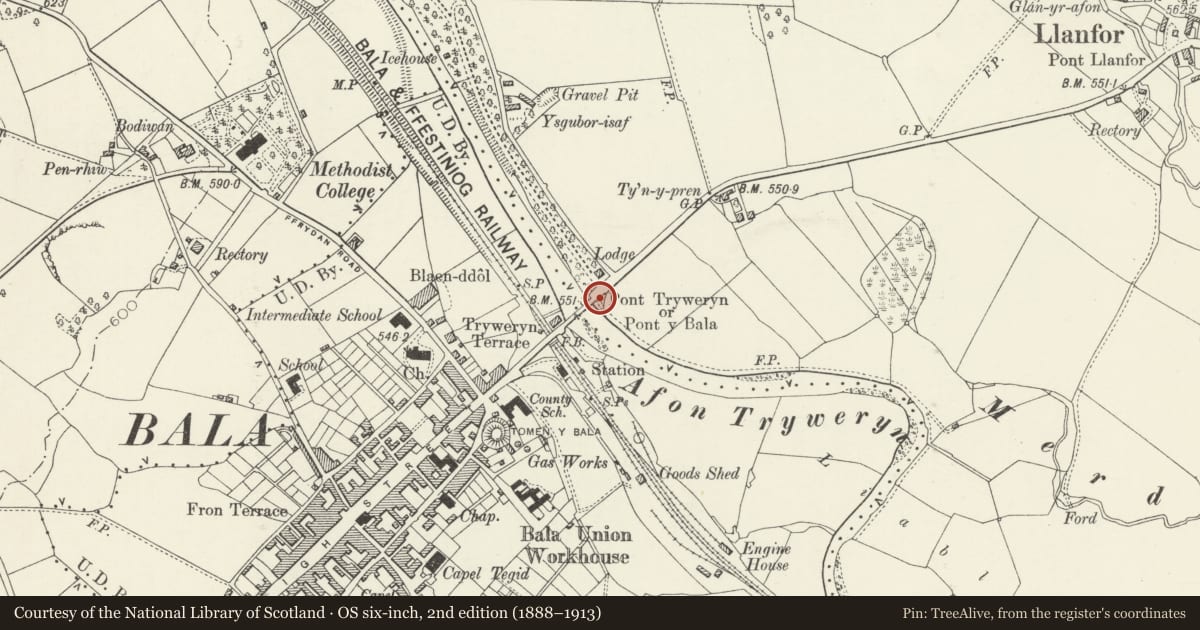
Slide toward Today to fade the historical sheet and see the modern map underneath.
David Rumsey Map Collection, Stanford LibrariesDavid Rumsey Map Collection, Stanford LibrariesLlyfrgell Genedlaethol Cymru – The National Library of WalesDavid Rumsey Map Collection, Stanford LibrariesDavid Rumsey Map Collection, Stanford Libraries
5 historical maps cover this location, the earliest the 1795 map "To Sir Watkin Williams-Wynn Bart ... the map of the six counties of North Wales is most humbly inscribed by his obedient humble servant" (Llyfrgell Genedlaethol Cymru – The National Library of Wales).
Historical maps covering this location
- 1795 · To Sir Watkin Williams-Wynn Bart ... the map of the six counties of North Wales is most… (Llyfrgell Genedlaethol Cymru – The National Library of Wales)
- 1830 · V.3:11-15:XV. Britisches Reich. A. Kon: England. b. Frstenthum Wales: Shire: 37-40 (David Rumsey Map Collection, Stanford Libraries)
- 1883 · Watershed map England, Wales 3. (David Rumsey Map Collection, Stanford Libraries)
- 1899 · 136 Bala (Hills) (David Rumsey Map Collection, Stanford Libraries)
- 1901 · Sheet 9 and 10. (David Rumsey Map Collection, Stanford Libraries)
Cadw's description
Location
Spanning the Afon Tryweryn and carrying the main road (A494) into the town of Bala.
History
Road bridge, probably of C17 origin, and presumably that shown in a sketch of Bala by Thomas Dinley in 1684. The bridge has been doubled in width on the downriver side within the last few decades.
Exterior
Long road bridge of rough-dressed rubble construction, snecked to the downriver side. The bridge has 4 segmental arches recessed below archrings of narrow stones; half-height triangular cutwaters to both sides, continuing to parapet height as shallow pilasters on the downriver side. Flat carriageway and plain, coped parapets. Cemented arch soffits; 3 pairs of modern street lights.
Reason for designation
Listed as an imposing bridge of C17 origin, historically the main approach to the town of Bala.
Nearby in the register
- Gateway and Screen Walls to RhiwlasGardens, Parks and Urban Spacesunder 1 mi
- Pont y Bala (partly in Llandderfel Community)Transportunder 1 mi
- Trem-y-fron, Including Forecourt Walls & RailingsDomesticunder 1 mi
- GlasfrynDomesticunder 1 mi
Other entries of the same register within about three miles of this one, by straight line.