Cof Cymru: National Historic Assets of Wales · Wales
15 Glan Dovey Terrace
Aberdovey, Gwynedd, Wales
A Grade II listed building in Aberdyfi, Aberdovey, Gwynedd, designated on 30 March 1951.
The record
- Designation
- Listed building, Grade II
- Broad class
- Commercial
- Date of designation
- 30 March 1951
- Locality
- Aberdyfi
- Community
- Aberdovey
- Unitary authority
- Gwynedd
- Country
- Wales
- Coordinates
- 52.54377, -4.04573
- Cadw reference
- 4635
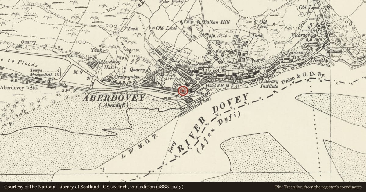
Slide toward Today to fade the historical sheet and see the modern map underneath.
David Rumsey Map Collection, Stanford LibrariesDavid Rumsey Map Collection, Stanford LibrariesDavid Rumsey Map Collection, Stanford LibrariesDavid Rumsey Map Collection, Stanford LibrariesDavid Rumsey Map Collection, Stanford Libraries
5 historical maps cover this location, the earliest the 1830 map "V.3:11-15:XV. Britisches Reich. A. Kon: England. b. Frstenthum Wales: Shire: 37-40" (David Rumsey Map Collection, Stanford Libraries).
Historical maps covering this location
- 1830 · V.3:11-15:XV. Britisches Reich. A. Kon: England. b. Frstenthum Wales: Shire: 37-40 (David Rumsey Map Collection, Stanford Libraries)
- 1883 · Watershed map England, Wales 3. (David Rumsey Map Collection, Stanford Libraries)
- 1896 · Sheet 7. Ordnance Survey of England and Wales. (David Rumsey Map Collection, Stanford Libraries)
- 1899 · 163 Aberystwyth (Hills) (David Rumsey Map Collection, Stanford Libraries)
- 1901 · Sheet 14. (David Rumsey Map Collection, Stanford Libraries)
Cadw's description
Location
Facing car park, to NW of Outward Bound boatsheds.
History
Early C19 reflected pair of houses; ground floors converted to shops late C19/early C20.
Exterior
Stucco, slate roof, end chimneys. Three storeys plus attic; broad hipped dormer to each house.
On first and second floors, outer bays have 2-storey bow windows with central 6-pane sash flanked by narrow sash, hornless sash glazing; 3 elliptical panels below each window of L house. To centre, second floor has paired 9-pane hornless sash windows each with semi-elliptical moulded fan above and quatrefoil between; L window retains flanking colonnettes. Paired 12-pane hornless sash windows to first floor under semi-elliptical panel, L window retains flanking colonettes. Ground floor has, to centre, steps up to recessed porch (Doric columns), paired entrance doors, 6-panelled with rectangular overlight.
Ends each have later (early C20?) shopfront with door set back between large shop windows.
Reason for designation
Included as well-detailed example of early C19 improvements of Aberdyfi, following building of turnpike road of 1827.
Nearby in the register
- 14 Glan Dovey TerraceCommercialunder 1 mi
- Medical HallCommercialunder 1 mi
- 6 Evans TerraceDomesticunder 1 mi
- 5 Evans TerraceDomesticunder 1 mi
Other entries of the same register within about three miles of this one, by straight line.