Cof Cymru: National Historic Assets of Wales · Wales
Foxhole
Llanbedrog, Gwynedd, Wales
A Grade II listed building in Llanbedrog, Pwllheli, Gwynedd, designated on 11 August 1989.
The record
- Designation
- Listed building, Grade II
- Broad class
- Domestic
- Date of designation
- 11 August 1989
- Locality
- Llanbedrog
- Town
- Pwllheli
- Community
- Llanbedrog
- Unitary authority
- Gwynedd
- Country
- Wales
- Coordinates
- 52.85314, -4.47898
- Cadw reference
- 4621
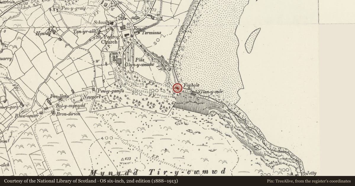
Slide toward Today to fade the historical sheet and see the modern map underneath.
David Rumsey Map Collection, Stanford LibrariesDavid Rumsey Map Collection, Stanford LibrariesDavid Rumsey Map Collection, Stanford LibrariesDavid Rumsey Map Collection, Stanford LibrariesDavid Rumsey Map Collection, Stanford Libraries
5 historical maps cover this location, the earliest the 1830 map "V.3:11-15:XV. Britisches Reich. A. Kon: England. b. Frstenthum Wales: Shire: 37-40" (David Rumsey Map Collection, Stanford Libraries).
Historical maps covering this location
- 1830 · V.3:11-15:XV. Britisches Reich. A. Kon: England. b. Frstenthum Wales: Shire: 37-40 (David Rumsey Map Collection, Stanford Libraries)
- 1883 · Watershed map England, Wales 3. (David Rumsey Map Collection, Stanford Libraries)
- 1896 · Sheet 7. Ordnance Survey of England and Wales. (David Rumsey Map Collection, Stanford Libraries)
- 1899 · 134 Pwllheli (Hills) (David Rumsey Map Collection, Stanford Libraries)
- 1901 · Sheet 9 and 10. (David Rumsey Map Collection, Stanford Libraries)
Cadw's description
Location
The building is located immediately above high tide level at the W end of Llanbedrog beach, below Trwyn Llanbedrog.
History
The cottages, formerly known as Foxhall, were probably built as fishermen's cottages in the late C18, and Gothicised in the C19 when they became part of the Plas Glyn-y-weddw Estate.
Exterior
Pair of cottages end-to-end built of rubble masonry and whitewashed, with a pitched slate roof closely cut to the eaves and verges. Single storey and loft, each cottage is of 2 window bays, with a central boarded door in a stone pointed arch to each cottage, flanked by small pane casement windows also set within openings with similar pointed heads. Two rooflights to the front roof pitch. Three tall stone stacks with water tabling, carrying late C19 terracotta flues, the shafts moulded with basketwork, and having octagonal moulded heads. Two small windows to the right end elevation, the one to the right having its original stone lintel. Small paned glazing. Similar small window to left on left end elevation. Blind rear elevation with retaining wall against hillside, and a modern passage cut along the back.
Interior
Not accessible at the time of inspection. Said from earlier inspection to have the internal layout of kitchen and living room largely intact. Rubble partition walls.
Reason for designation
Included as an interesting example of a pair of small fishermen's cottages of the N Wales coast, and later converted as a picturesque element in the dramatic setting of Glyn-y-weddw.
Nearby in the register
- Plas Glyn-y-WeddwEducationunder 1 mi
- Church of St PedrogReligious, Ritual and Funeraryunder 1 mi
- Lychgate to the churchyard of the Church of St PedrogReligious, Ritual and Funeraryunder 1 mi
- The CottageDomesticunder 1 mi
Other entries of the same register within about three miles of this one, by straight line.