Cof Cymru: National Historic Assets of Wales · Wales
13 North Street
Pwllheli, Gwynedd, Wales
A Grade II listed building in Pwllheli, Gwynedd, designated on 28 July 1989.
The record
- Designation
- Listed building, Grade II
- Broad class
- Domestic
- Date of designation
- 28 July 1989
- Community
- Pwllheli
- Unitary authority
- Gwynedd
- Country
- Wales
- Coordinates
- 52.89103, -4.41555
- Cadw reference
- 4555
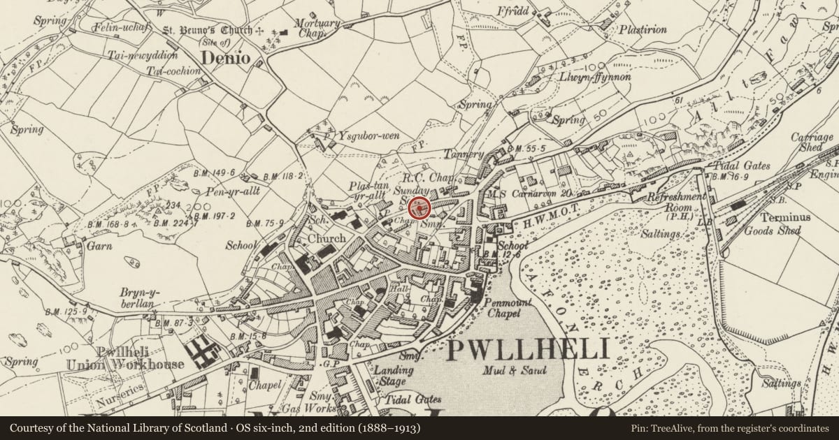
Slide toward Today to fade the historical sheet and see the modern map underneath.
David Rumsey Map Collection, Stanford LibrariesDavid Rumsey Map Collection, Stanford LibrariesDavid Rumsey Map Collection, Stanford LibrariesDavid Rumsey Map Collection, Stanford LibrariesDavid Rumsey Map Collection, Stanford Libraries
5 historical maps cover this location, the earliest the 1830 map "V.3:11-15:XV. Britisches Reich. A. Kon: England. b. Frstenthum Wales: Shire: 37-40" (David Rumsey Map Collection, Stanford Libraries).
Historical maps covering this location
- 1830 · V.3:11-15:XV. Britisches Reich. A. Kon: England. b. Frstenthum Wales: Shire: 37-40 (David Rumsey Map Collection, Stanford Libraries)
- 1883 · Watershed map England, Wales 3. (David Rumsey Map Collection, Stanford Libraries)
- 1896 · Sheet 7. Ordnance Survey of England and Wales. (David Rumsey Map Collection, Stanford Libraries)
- 1899 · 134 Pwllheli (Hills) (David Rumsey Map Collection, Stanford Libraries)
- 1901 · Sheet 9 and 10. (David Rumsey Map Collection, Stanford Libraries)
Cadw's description
Location
At the roadside near E end of the street; detached following demolition of Nos 17 and 19.
Exterior
Local stone houses with distinct masonry break between the 2-window fronts. No 13 to right is the earlier, probably ca 1800 and is 20-storey and basement. No 15 to left is also shown on John Wood’s 1834 map; it is 3-storeys of neatly coursed rubble. Slate roofs with rubble chimney stacks, that to right is cement rendered; narrow eaves. 4pane sash windows with deep lintels to No 13 and deeply recessed doorway to centre with 6 panel door and fanlight. 16 pane sash windows to 1st and ground floors to No 15 and 8 pane pivot windows to 2nd floor; 6 panel part glazed door to left. 2 modern windows on right gable end and 4 panel basement door. No 13 formerly had a short terrace extending to rear opposite that part of Tanyrallt that remains. No 15 is slightly deeper and has 4 pane and some modern windows.
Nearby in the register
- 15 North StreetDomesticunder 1 mi
- 1 North TerraceDomesticunder 1 mi
- 2 North TerraceDomesticunder 1 mi
- 3 North TerraceDomesticunder 1 mi
Other entries of the same register within about three miles of this one, by straight line.