Cof Cymru: National Historic Assets of Wales · Wales
Vron Chambers (John Morris & Co.)
Holywell, Flintshire, Wales
A Grade II listed building in Holywell, Flintshire, designated on 19 August 1991.
The record
- Designation
- Listed building, Grade II
- Broad class
- Commercial
- Date of designation
- 19 August 1991
- Community
- Holywell
- Unitary authority
- Flintshire
- Country
- Wales
- Coordinates
- 53.27284, -3.22089
- Cadw reference
- 451
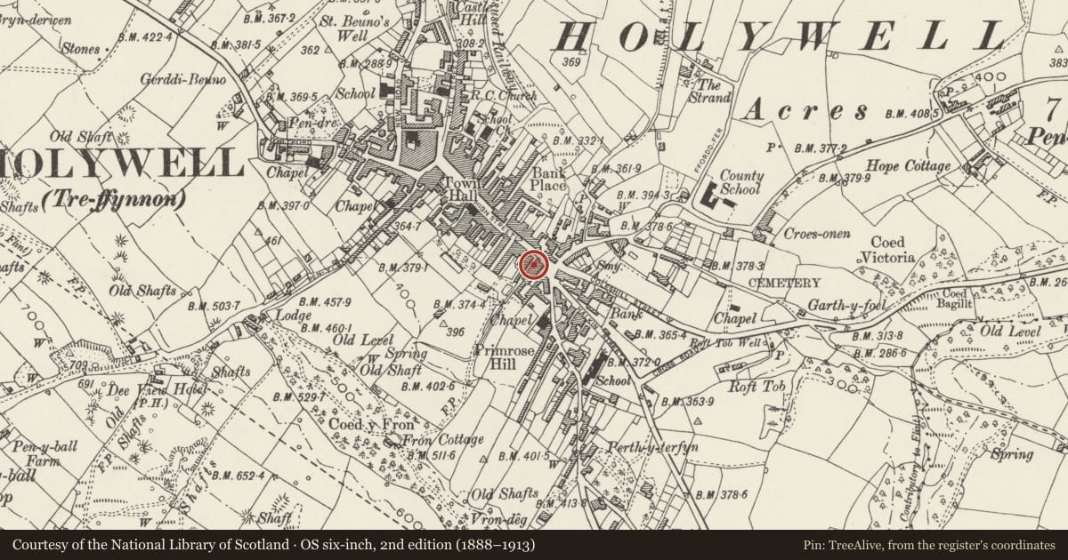
Slide toward Today to fade the historical sheet and see the modern map underneath.
David Rumsey Map Collection, Stanford LibrariesDavid Rumsey Map Collection, Stanford LibrariesDavid Rumsey Map Collection, Stanford LibrariesLlyfrgell Genedlaethol Cymru – The National Library of WalesDavid Rumsey Map Collection, Stanford Libraries
5 historical maps cover this location, the earliest the 1795 map "To Sir Watkin Williams-Wynn Bart ... the map of the six counties of North Wales is most humbly inscribed by his obedient humble servant" (Llyfrgell Genedlaethol Cymru – The National Library of Wales).
Historical maps covering this location
- 1795 · To Sir Watkin Williams-Wynn Bart ... the map of the six counties of North Wales is most… (Llyfrgell Genedlaethol Cymru – The National Library of Wales)
- 1830 · V.3:11-15:XV. Britisches Reich. A. Kon: England. b. Frstenthum Wales: Shire: 37-40 (David Rumsey Map Collection, Stanford Libraries)
- 1883 · Watershed map England, Wales 3. (David Rumsey Map Collection, Stanford Libraries)
- 1896 · 96 Liverpool (Hills) (David Rumsey Map Collection, Stanford Libraries)
- 1901 · Sheet 9 and 10. (David Rumsey Map Collection, Stanford Libraries)
Cadw's description
Location
Set forward to right of King's Head Hotel; lane to right beside Post Office.
History
Probably earlier C18 origins and early to mid C19 remodelling. Old photographs show that it was formerly a commercial building with hoist to the then gabled front.
Exterior
3-storey, 1-window front; scribed render with channelled quoins. Hipped slate roof and 16-pane sash windows. 'Shop front' (formerly to a Chemist's shop) with small pane bow window slants outwards to left and has similar bow window on the return elevation facing up the street.
Scribed render side elevation with plinth sloping up lane; 1st floor sill band and architraves; 2+6-windows to 1st floor, fewer to 2nd and ground floors. Camber-arched doorway with boarded door and lions head (knocker missing). Cemented quarter-round kneeler to rear gable end.
.
Reason for designation
Group value
Nearby in the register
- The King's Head PHCommercialunder 1 mi
- Telephone Call-box outside The Post OfficeCommunicationsunder 1 mi
- 1Domesticunder 1 mi
- 2Domesticunder 1 mi
Other entries of the same register within about three miles of this one, by straight line.