Cof Cymru: National Historic Assets of Wales · Wales
Lo-Cost Foodstore
Pwllheli, Gwynedd, Wales
A Grade II listed building in Pwllheli, Gwynedd, designated on 28 July 1989.
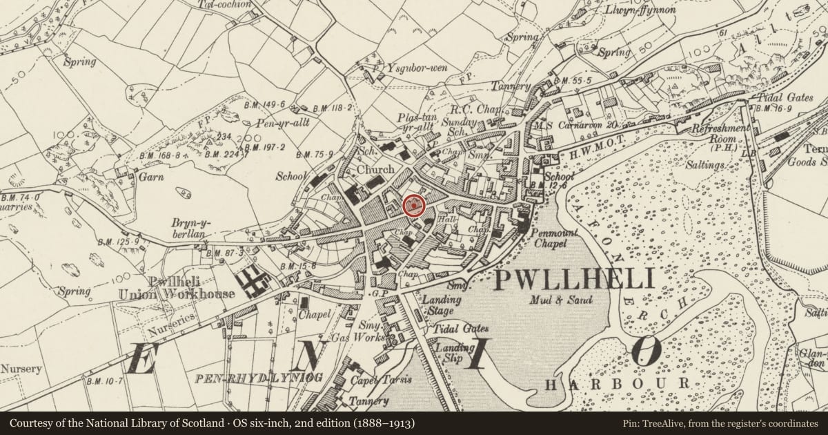
The record
- Designation
- Listed building, Grade II
- Broad class
- Commercial
- Date of designation
- 28 July 1989
- Community
- Pwllheli
- Unitary authority
- Gwynedd
- Country
- Wales
- Coordinates
- 52.88978, -4.41721
- Cadw reference
- 4497
Slide toward Today to fade the historical sheet and see the modern map underneath.
David Rumsey Map Collection, Stanford LibrariesDavid Rumsey Map Collection, Stanford LibrariesDavid Rumsey Map Collection, Stanford LibrariesDavid Rumsey Map Collection, Stanford LibrariesDavid Rumsey Map Collection, Stanford Libraries
5 historical maps cover this location, the earliest the 1830 map "V.3:11-15:XV. Britisches Reich. A. Kon: England. b. Frstenthum Wales: Shire: 37-40" (David Rumsey Map Collection, Stanford Libraries).
Historical maps covering this location
- 1830 · V.3:11-15:XV. Britisches Reich. A. Kon: England. b. Frstenthum Wales: Shire: 37-40 (David Rumsey Map Collection, Stanford Libraries)
- 1883 · Watershed map England, Wales 3. (David Rumsey Map Collection, Stanford Libraries)
- 1896 · Sheet 7. Ordnance Survey of England and Wales. (David Rumsey Map Collection, Stanford Libraries)
- 1899 · 134 Pwllheli (Hills) (David Rumsey Map Collection, Stanford Libraries)
- 1901 · Sheet 9 and 10. (David Rumsey Map Collection, Stanford Libraries)
Cadw's description
Location
Stepped forward from Tower Hotel to left.
History
Earlier C19
Exterior
3-storey, 2-window scribed render front with slate roof and red brick chimney stack, heightened following rebuilding of Tower Hotel, 9 and 12 pane sash windows, lugged architraves to 1st floor. Out of character modern overall shop front.
The earliest Tower Hotel seems to have been in-line with the other street fronts - see chimney breast projection on left end.
Reason for designation
Included for group value with neighbouring listed items.
Nearby in the register
- PolecoffsCommercialunder 1 mi
- Tower Hotel (including Courtyard Ranges)Commercialunder 1 mi
- ChemistCommercialunder 1 mi
- 58 High StreetCommercialunder 1 mi
Other entries of the same register within about three miles of this one, by straight line.