Cof Cymru: National Historic Assets of Wales · Wales
Penlan Chapel Hall
Pwllheli, Gwynedd, Wales
A Grade II listed building in Pwllheli, Gwynedd, designated on 28 July 1989.
The record
- Designation
- Listed building, Grade II
- Broad class
- Religious, Ritual and Funerary
- Date of designation
- 28 July 1989
- Locality
- Pwllheli
- Community
- Pwllheli
- Unitary authority
- Gwynedd
- Country
- Wales
- Coordinates
- 52.88873, -4.41803
- Cadw reference
- 4490
Slide toward Today to fade the historical sheet and see the modern map underneath.
David Rumsey Map Collection, Stanford LibrariesDavid Rumsey Map Collection, Stanford LibrariesDavid Rumsey Map Collection, Stanford LibrariesDavid Rumsey Map Collection, Stanford LibrariesDavid Rumsey Map Collection, Stanford Libraries
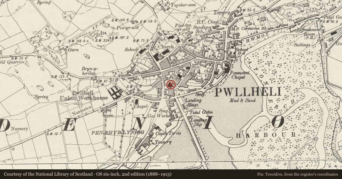
5 historical maps cover this location, the earliest the 1830 map "V.3:11-15:XV. Britisches Reich. A. Kon: England. b. Frstenthum Wales: Shire: 37-40" (David Rumsey Map Collection, Stanford Libraries).
Historical maps covering this location
- 1830 · V.3:11-15:XV. Britisches Reich. A. Kon: England. b. Frstenthum Wales: Shire: 37-40 (David Rumsey Map Collection, Stanford Libraries)
- 1883 · Watershed map England, Wales 3. (David Rumsey Map Collection, Stanford Libraries)
- 1896 · Sheet 7. Ordnance Survey of England and Wales. (David Rumsey Map Collection, Stanford Libraries)
- 1899 · 134 Pwllheli (Hills) (David Rumsey Map Collection, Stanford Libraries)
- 1901 · Sheet 9 and 10. (David Rumsey Map Collection, Stanford Libraries)
Cadw's description
Location
Set back near the bottom of the hill, above the road; hall elevation to Mitre Place.
History
Built 1863, hall added after 1889 (not shown on 1st edition OS map); renovated in 1960 and again in 1988.
Exterior
5-bay left hand side with similar windows set in shallow recesses. The hall range extends by 1 bay to left side. The windows on the right hand side are small pane.
The hall has a pedimented scribed render Mitre Place elevation with the pilasters; pediment base broke by round arched head of blind central window with quoins and cill band. 3 similar openings below with imposts; small pane sash windows with marginal glazing bars flank double door entrance. High panelled base. Low rubble wall to forecourt.
Reason for designation
Group value with Nos 16 to 20 Gaol Street.
Nearby in the register
- Penlan ChapelReligious, Ritual and Funeraryunder 1 mi
- T.N.WilliamsCommercialunder 1 mi
- AlcatrazDomesticunder 1 mi
- 16 Gaol StreetDomesticunder 1 mi
Other entries of the same register within about three miles of this one, by straight line.