Cof Cymru: National Historic Assets of Wales · Wales
Bronhaul
Porthmadog, Gwynedd, Wales
A Grade II listed building in Tremadog, Porthmadog, Gwynedd, designated on 1 April 1974.
The record
- Designation
- Listed building, Grade II
- Broad class
- Domestic
- Date of designation
- 1 April 1974
- Locality
- Tremadog
- Community
- Porthmadog
- Unitary authority
- Gwynedd
- Country
- Wales
- Coordinates
- 52.94090, -4.13882
- Cadw reference
- 4448
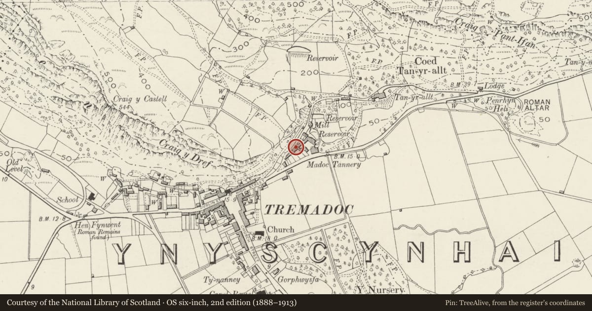
Slide toward Today to fade the historical sheet and see the modern map underneath.
David Rumsey Map Collection, Stanford LibrariesDavid Rumsey Map Collection, Stanford LibrariesDavid Rumsey Map Collection, Stanford LibrariesLlyfrgell Genedlaethol Cymru – The National Library of WalesDavid Rumsey Map Collection, Stanford Libraries
5 historical maps cover this location, the earliest the 1795 map "To Sir Watkin Williams-Wynn Bart ... the map of the six counties of North Wales is most humbly inscribed by his obedient humble servant" (Llyfrgell Genedlaethol Cymru – The National Library of Wales).
Historical maps covering this location
- 1795 · To Sir Watkin Williams-Wynn Bart ... the map of the six counties of North Wales is most… (Llyfrgell Genedlaethol Cymru – The National Library of Wales)
- 1883 · Watershed map England, Wales 3. (David Rumsey Map Collection, Stanford Libraries)
- 1896 · Sheet 7. Ordnance Survey of England and Wales. (David Rumsey Map Collection, Stanford Libraries)
- 1899 · 119 Snowdon (Hills) (David Rumsey Map Collection, Stanford Libraries)
- 1901 · Sheet 9 and 10. (David Rumsey Map Collection, Stanford Libraries)
Cadw's description
Location
Set well back from the main road (A498) adjoining Tremdog Manufactory to the E, approximately 250m ENE of Tremadog Market Square.
History
Probably built as a manager's house and contemporary with the Tremadog Manufactory, built 1805-6. It is shown on the 1842 Tithe map. Uninhabited at the time of survey.
Exterior
A 2-storey 3-window house of blocks quarried stone laid in regular courses and with larger blocks near the base, under a corrugated metal roof with stone stack to the L. Openings are offset to the L side. A porch, roofless at the time of inspection, has walls of coursed stone and scribed render, and a slate pediment. The doorway has a fielded-panel door but it is not fixed and was probably brought from another site. Windows, formerly with sashes, have been boarded up. In the lower storey they have pronounced slate lintels. In the upper storey they have thinner slate lintels, are shorter, and the central window is shorter still.
A parallel range on the R side of the rear is built into the steep bank behind the house, and has a doorway opening to a small yard between the main range, Manufactory and embankment.
Interior
Not accessible at the time of survey.
Reason for designation
Listed, notwithstanding its condition, as an early C19 house retaining early character and notable for its distinctive use of local stone, as part of a well-preserved early C19 group including workers' housing and the Manufactory, and for its contribution to the historical integrity of Tremadog.
Nearby in the register
- Ty GwynDomesticunder 1 mi
- Tremadog ManufactoryIndustrialunder 1 mi
- Ivy CottageNo class recordedunder 1 mi
- Y BwthynNo class recordedunder 1 mi
Other entries of the same register within about three miles of this one, by straight line.