Cof Cymru: National Historic Assets of Wales · Wales
Rectory
Criccieth, Gwynedd, Wales
A Grade II listed building in Criccieth, Gwynedd, designated on 2 August 1949.
The record
- Designation
- Listed building, Grade II
- Broad class
- Domestic
- Date of designation
- 2 August 1949
- Community
- Criccieth
- Unitary authority
- Gwynedd
- Country
- Wales
- Coordinates
- 52.92103, -4.23269
- Cadw reference
- 4398
Slide toward Today to fade the historical sheet and see the modern map underneath.
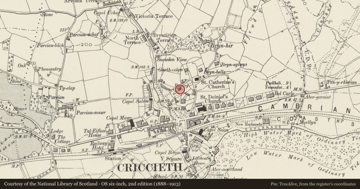
David Rumsey Map Collection, Stanford LibrariesDavid Rumsey Map Collection, Stanford LibrariesDavid Rumsey Map Collection, Stanford LibrariesLlyfrgell Genedlaethol Cymru – The National Library of WalesDavid Rumsey Map Collection, Stanford Libraries
5 historical maps cover this location, the earliest the 1795 map "To Sir Watkin Williams-Wynn Bart ... the map of the six counties of North Wales is most humbly inscribed by his obedient humble servant" (Llyfrgell Genedlaethol Cymru – The National Library of Wales).
Historical maps covering this location
- 1795 · To Sir Watkin Williams-Wynn Bart ... the map of the six counties of North Wales is most… (Llyfrgell Genedlaethol Cymru – The National Library of Wales)
- 1883 · Watershed map England, Wales 3. (David Rumsey Map Collection, Stanford Libraries)
- 1896 · Sheet 7. Ordnance Survey of England and Wales. (David Rumsey Map Collection, Stanford Libraries)
- 1899 · 118 Nevin (Hills) (David Rumsey Map Collection, Stanford Libraries)
- 1901 · Sheet 9 and 10. (David Rumsey Map Collection, Stanford Libraries)
Cadw's description
Location
In grounds set back from the NE side of the open green of Y Maes, close to Holywell Terrace.
History
Built c1828-1831 as a glebe house to the rectory (which was then at Mynydd Ednyfydd); extended in 1904.
Exterior
Well courses and squared stone, and slate roof with strong overhand to eaves. 2 storeys, 3-window range. Central entrance with paired 3-panelled doors and radial fanlight in added porch. Flanking low 12-pane sash windows, and 9-pane sashes to first floor. Lower extension against left-hand gable return with 3x12-pane sash windows in the gable end and entrance in rear was added in 1904, largely to provide additional service accommodation.
Interior
The layout of the principal rooms to either side of a wide entrance and stair hall, and the plain-spindle staircase, survive, but there are few other remaining original details.
Reason for designation
A good example of a substantial house of c1830 in a simplified classical style, which has retained its external character.
Nearby in the register
- Hafod y BrynDomesticunder 1 mi
- Church of St CatherineReligious, Ritual and Funeraryunder 1 mi
- Memorial HallCommemorativeunder 1 mi
- Bryn HenllanDomesticunder 1 mi
Other entries of the same register within about three miles of this one, by straight line.