Cof Cymru: National Historic Assets of Wales · Wales
25
Holywell, Flintshire, Wales
A Grade II listed building in Holywell, Flintshire, designated on 19 August 1991.
The record
- Designation
- Listed building, Grade II
- Broad class
- Commercial
- Date of designation
- 19 August 1991
- Community
- Holywell
- Unitary authority
- Flintshire
- Country
- Wales
- Coordinates
- 53.27387, -3.22216
- Cadw reference
- 435
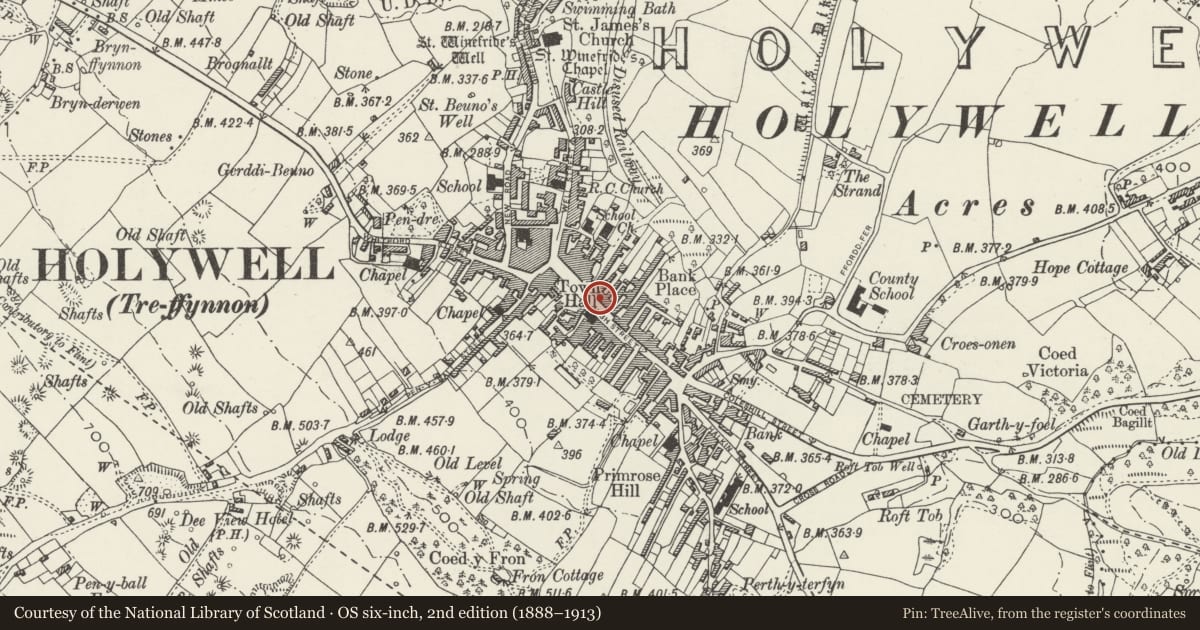
Slide toward Today to fade the historical sheet and see the modern map underneath.
David Rumsey Map Collection, Stanford LibrariesDavid Rumsey Map Collection, Stanford LibrariesDavid Rumsey Map Collection, Stanford LibrariesLlyfrgell Genedlaethol Cymru – The National Library of WalesDavid Rumsey Map Collection, Stanford Libraries
5 historical maps cover this location, the earliest the 1795 map "To Sir Watkin Williams-Wynn Bart ... the map of the six counties of North Wales is most humbly inscribed by his obedient humble servant" (Llyfrgell Genedlaethol Cymru – The National Library of Wales).
Historical maps covering this location
- 1795 · To Sir Watkin Williams-Wynn Bart ... the map of the six counties of North Wales is most… (Llyfrgell Genedlaethol Cymru – The National Library of Wales)
- 1830 · V.3:11-15:XV. Britisches Reich. A. Kon: England. b. Frstenthum Wales: Shire: 37-40 (David Rumsey Map Collection, Stanford Libraries)
- 1883 · Watershed map England, Wales 3. (David Rumsey Map Collection, Stanford Libraries)
- 1896 · 96 Liverpool (Hills) (David Rumsey Map Collection, Stanford Libraries)
- 1901 · Sheet 9 and 10. (David Rumsey Map Collection, Stanford Libraries)
Cadw's description
Location
Midway along the street, stepped down and back from London House to right
History
Earlier C19 (shown on 1833 map) late-Georgian planned group. No 25 is broader as it originally spanned the through passage to rear courtyard; No 27 was formerly the Spread Eagle PH.
Exterior
3-storey stucco fronts, 2-window to Nos 23 and 27 and 3-window to No 25; distinctive overall coved eaves cornice and quoins to left end. Slate roof with cement redered and red brick chimney stacks. Small pane sash windows arranged (except over former through passage) in a syncopated manner with one 2nd floor window to each pair of 1st floor windows; horizontally slidding sashes to 2nd floor except to No 27, where one 1st floor window has also been altered. Projecting shop fronts with out of character modernisation to Nos 25 and 27; No 23 retains blind box and scrolled fascia end brackets. Gabled cross ranges to rear with various sash windows; monopitch cross range to No 23 with camber headed openings.
Reason for designation
Included for group value with other listed items on High Street (NE side).
Nearby in the register
- 27Commercialunder 1 mi
- 23Commercialunder 1 mi
- 29Commercialunder 1 mi
- Facade of Former Town HallCivilunder 1 mi
Other entries of the same register within about three miles of this one, by straight line.