Cof Cymru: National Historic Assets of Wales · Wales
Fronheulog
Llanystumdwy, Gwynedd, Wales
A Grade II listed building in Llangybi, Pwllheli, Llanystumdwy, Gwynedd, designated on 19 October 1971.
The record
- Designation
- Listed building, Grade II
- Broad class
- Domestic
- Date of designation
- 19 October 1971
- Locality
- Llangybi
- Town
- Pwllheli
- Community
- Llanystumdwy
- Unitary authority
- Gwynedd
- Country
- Wales
- Coordinates
- 52.94465, -4.34075
- Cadw reference
- 4345
Slide toward Today to fade the historical sheet and see the modern map underneath.
David Rumsey Map Collection, Stanford LibrariesDavid Rumsey Map Collection, Stanford LibrariesDavid Rumsey Map Collection, Stanford LibrariesDavid Rumsey Map Collection, Stanford LibrariesLlyfrgell Genedlaethol Cymru – The National Library of Wales
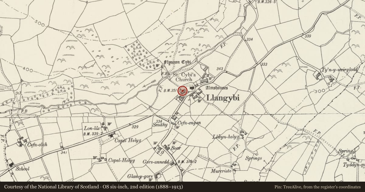
5 historical maps cover this location, the earliest the 1795 map "To Sir Watkin Williams-Wynn Bart ... the map of the six counties of North Wales is most humbly inscribed by his obedient humble servant" (Llyfrgell Genedlaethol Cymru – The National Library of Wales).
Historical maps covering this location
- 1795 · To Sir Watkin Williams-Wynn Bart ... the map of the six counties of North Wales is most… (Llyfrgell Genedlaethol Cymru – The National Library of Wales)
- 1883 · Watershed map England, Wales 3. (David Rumsey Map Collection, Stanford Libraries)
- 1896 · Sheet 7. Ordnance Survey of England and Wales. (David Rumsey Map Collection, Stanford Libraries)
- 1899 · 118 Nevin (Hills) (David Rumsey Map Collection, Stanford Libraries)
- 1901 · Sheet 9 and 10. (David Rumsey Map Collection, Stanford Libraries)
Cadw's description
Location
Fronheulog is a short row of two cottages immediately SW of the church, behind Bryn Aber and backing on to the graveyard extension.
History
Probably early-mid C19 though perhaps converting an earlier building, and forming part of a larger row. Fronheulog originally comprised a pair of cottages but is now a single dwelling.
Exterior
2 storey, 2 window range cottage. Large rubble stone construction with renewed slate roof; roughcast render to gable wall and to (rebuilt) gable end stack. Doorway to right of centre with former doorway of second cottage (now a 16-pane sash window) alongside it to the left. Other windows are 12-pane sashes, with similar windows in gabled half-dormers above.
Reason for designation
Included for group value with the church and adjoining buildings at the centre of Llangybi.
Nearby in the register
- Cottage and Outbuilding, adjoining FronheulogDomesticunder 1 mi
- Cross-Incised Stone in Llangybi ChurchyardCross-marked stoneunder 1 mi
- Lychgate and Churchyard Wall to the Church of St CybiReligious, Ritual and Funeraryunder 1 mi
- Ty'n-y-porthDomesticunder 1 mi
Other entries of the same register within about three miles of this one, by straight line.