Cof Cymru: National Historic Assets of Wales · Wales
Bodfel-bach
Llannor, Gwynedd, Wales
A Grade II listed building in Efailnewydd, Pwllheli, Llannor, Gwynedd, designated on 19 October 1971.
The record
- Designation
- Listed building, Grade II
- Broad class
- Domestic
- Date of designation
- 19 October 1971
- Locality
- Efailnewydd
- Town
- Pwllheli
- Community
- Llannor
- Unitary authority
- Gwynedd
- Country
- Wales
- Coordinates
- 52.90252, -4.46874
- Cadw reference
- 4335
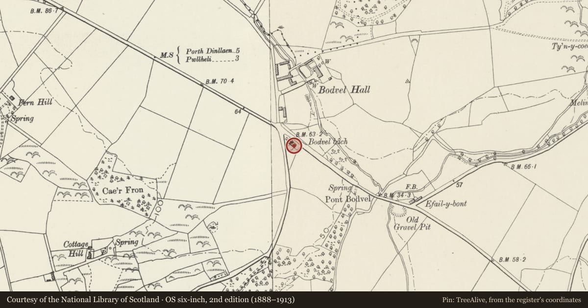
Slide toward Today to fade the historical sheet and see the modern map underneath.
David Rumsey Map Collection, Stanford LibrariesDavid Rumsey Map Collection, Stanford LibrariesDavid Rumsey Map Collection, Stanford LibrariesDavid Rumsey Map Collection, Stanford LibrariesDavid Rumsey Map Collection, Stanford Libraries
5 historical maps cover this location, the earliest the 1830 map "V.3:11-15:XV. Britisches Reich. A. Kon: England. b. Frstenthum Wales: Shire: 37-40" (David Rumsey Map Collection, Stanford Libraries).
Historical maps covering this location
- 1830 · V.3:11-15:XV. Britisches Reich. A. Kon: England. b. Frstenthum Wales: Shire: 37-40 (David Rumsey Map Collection, Stanford Libraries)
- 1883 · Watershed map England, Wales 3. (David Rumsey Map Collection, Stanford Libraries)
- 1896 · Sheet 7. Ordnance Survey of England and Wales. (David Rumsey Map Collection, Stanford Libraries)
- 1899 · 134 Pwllheli (Hills) (David Rumsey Map Collection, Stanford Libraries)
- 1901 · Sheet 9 and 10. (David Rumsey Map Collection, Stanford Libraries)
Cadw's description
Location
The former farmhouse is located in the SE angle of the crossroads NW of Efailnewydd.
History
The building was probably built in the C17, with later additions and modifications, including refurbishment in the late 1990s. However it is not shown on the early C19 Bodvel Estate map in the Vaynol Collection but appears on the draft Ordnance Survey map of 1816.
Exterior
Built of local stone rubble, rendered and lined out to the front, with some large boulder quoins, all whitewashed, with a slate roof. The plan is derived from a main range and cross wing type forming a 'T'-plan, with a large added lean-to in the major re-entrant angle and an added single storey kitchen with a hipped roof. The front elevation, facing SE, has the entrance, a partly glazed door in the angle with the wing on the left, and hipped slated porch. Deeply set 16-pane sash windows to both floors, and a small 4-pane window to the attic in the wing. The wing also has a side stack, and a large part-external rear stack, both rendered.
Attached farm buildings to the NW partly converted as a garage, with the piggery beyond.
Interior
Not accessible at the time of inspection. Believed to be fully modernised.
Reason for designation
Included as a gentry type house of C17 origin with an unusual storeyed plan form.
Nearby in the register
- BodfelDomesticunder 1 mi
- Pont BodfelTransportunder 1 mi
- Cefn MineDomesticunder 1 mi
- Pont Rhyd-hirTransportunder 1 mi
Other entries of the same register within about three miles of this one, by straight line.