Cof Cymru: National Historic Assets of Wales · Wales
Remains of Chapel
Llanengan, Gwynedd, Wales
A Grade II listed building in St Tudwal's Island East, Pwllheli, Llanengan, Gwynedd, designated on 19 October 1971.
The record
- Designation
- Listed building, Grade II
- Broad class
- Religious, Ritual and Funerary
- Date of designation
- 19 October 1971
- Locality
- St Tudwal's Island East
- Town
- Pwllheli
- Community
- Llanengan
- Unitary authority
- Gwynedd
- Country
- Wales
- Coordinates
- 52.80485, -4.46160
- Cadw reference
- 4315
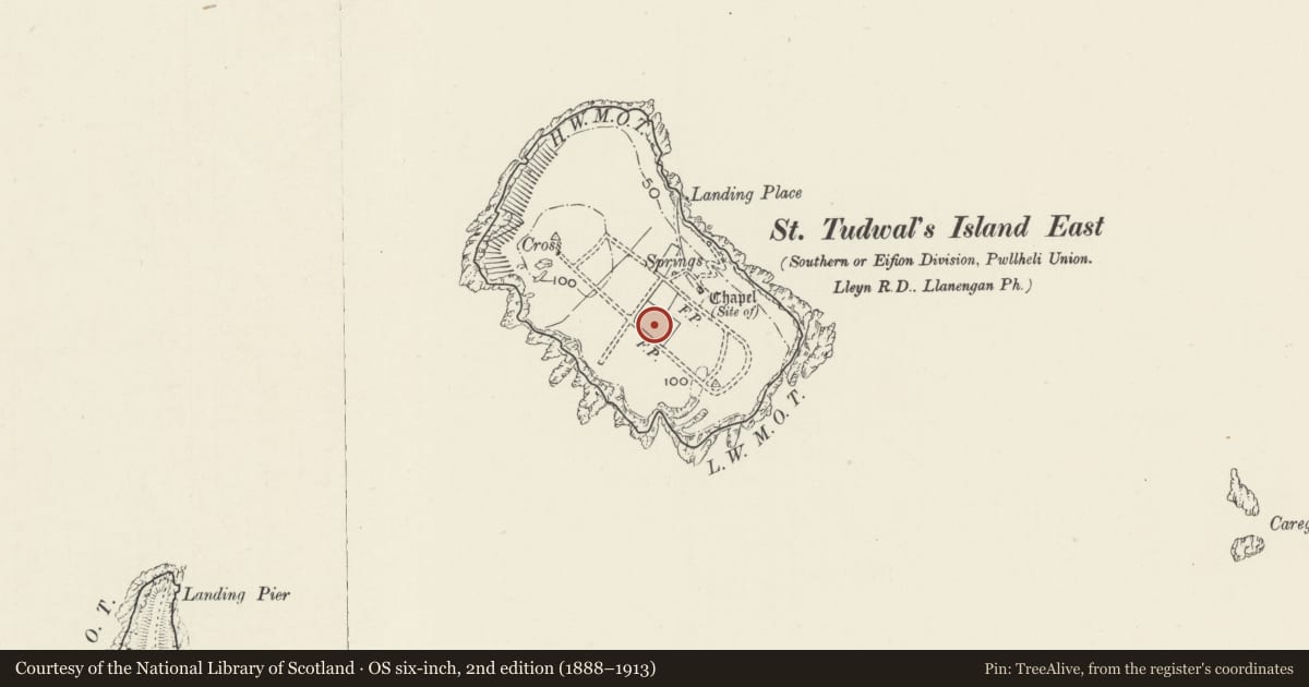
Slide toward Today to fade the historical sheet and see the modern map underneath.
David Rumsey Map Collection, Stanford LibrariesDavid Rumsey Map Collection, Stanford LibrariesDavid Rumsey Map Collection, Stanford LibrariesDavid Rumsey Map Collection, Stanford LibrariesDavid Rumsey Map Collection, Stanford Libraries
5 historical maps cover this location, the earliest the 1830 map "V.3:11-15:XV. Britisches Reich. A. Kon: England. b. Frstenthum Wales: Shire: 37-40" (David Rumsey Map Collection, Stanford Libraries).
Historical maps covering this location
- 1830 · V.3:11-15:XV. Britisches Reich. A. Kon: England. b. Frstenthum Wales: Shire: 37-40 (David Rumsey Map Collection, Stanford Libraries)
- 1883 · Watershed map England, Wales 3. (David Rumsey Map Collection, Stanford Libraries)
- 1896 · Sheet 7. Ordnance Survey of England and Wales. (David Rumsey Map Collection, Stanford Libraries)
- 1899 · 134 Pwllheli (Hills) (David Rumsey Map Collection, Stanford Libraries)
- 1901 · Sheet 9 and 10. (David Rumsey Map Collection, Stanford Libraries)
Cadw's description
Location
Situated on the E side of the otherwise empty St Tudwal's East Island.
History
Former chapel, now house. It seems that the present structure may have C18 origins dating from when the island was still farmed but in 1886-7 was altered to a chapel by Father Hughes, who attempted to start a monastery there. It fell into disrepair and was reroofed and altered as a holiday house in the 1990s. It was listed in 1971 because it occupies part of the site of small Augustinian priory mentioned from 1291.
Exterior
Former chapel, now house. Rubble stone with C20 rebuilt slate roof. Small rectangular building including some medieval stonework. Arched door on E side with one small window to right.
Reason for designation
Although initially listed for the medieval foundations only, the present building is of historic interest for the failed monastery of Father Hughes and may include medieval walling in SW and SE walls.
Nearby in the register
- Remains of HallDomesticunder 1 mi
- St Tudwal's LighthouseMaritimeunder 1 mi
- Enclosure Walls at St Tudwal's LighthouseMaritimeunder 1 mi
- Former Keepers' Accommodation at St Tudwal's LighthouseDomesticunder 1 mi
Other entries of the same register within about three miles of this one, by straight line.