Cof Cymru: National Historic Assets of Wales · Wales
Barn at Crugan Farm
Llanbedrog, Gwynedd, Wales
A Grade II listed building in Llanbedrog, Pwllheli, Gwynedd, designated on 19 October 1971.
The record
- Designation
- Listed building, Grade II
- Broad class
- Agriculture and Subsistence
- Date of designation
- 19 October 1971
- Locality
- Llanbedrog
- Town
- Pwllheli
- Community
- Llanbedrog
- Unitary authority
- Gwynedd
- Country
- Wales
- Coordinates
- 52.86321, -4.47436
- Cadw reference
- 4301
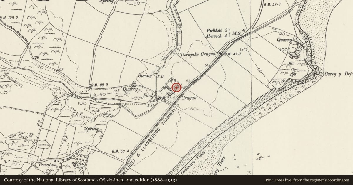
Slide toward Today to fade the historical sheet and see the modern map underneath.
David Rumsey Map Collection, Stanford LibrariesDavid Rumsey Map Collection, Stanford LibrariesDavid Rumsey Map Collection, Stanford LibrariesDavid Rumsey Map Collection, Stanford LibrariesDavid Rumsey Map Collection, Stanford Libraries
5 historical maps cover this location, the earliest the 1830 map "V.3:11-15:XV. Britisches Reich. A. Kon: England. b. Frstenthum Wales: Shire: 37-40" (David Rumsey Map Collection, Stanford Libraries).
Historical maps covering this location
- 1830 · V.3:11-15:XV. Britisches Reich. A. Kon: England. b. Frstenthum Wales: Shire: 37-40 (David Rumsey Map Collection, Stanford Libraries)
- 1883 · Watershed map England, Wales 3. (David Rumsey Map Collection, Stanford Libraries)
- 1896 · Sheet 7. Ordnance Survey of England and Wales. (David Rumsey Map Collection, Stanford Libraries)
- 1899 · 134 Pwllheli (Hills) (David Rumsey Map Collection, Stanford Libraries)
- 1901 · Sheet 9 and 10. (David Rumsey Map Collection, Stanford Libraries)
Cadw's description
Location
Crugan lies E of Llanbedrog, on the N side of the road to Pwllheli. The barn is within a range of farm buildings in line with the farm house, extending to the NE.
History
The barn is probably of the C18, altered in the C20.
Exterior
The barn is built of green crystalline stone with galletted joints, and is roofed in corrugated iron. Four bays, with opposed doors in the 2nd bay from the SW end, projecting stones flanking the main door to the farmyard. Three slit windows, now filled. The barn continues to the NE as a 3-bay cowhouse; this has a single door to the yard, now covered by later buildings.
Interior
The roof trusses of the barn have been replaced with sawn timber trusses following the general form of the original. The eastwards extension has two original collar trusses, the principals crossed and pegged at the apex. Stalls across the building at each end.
Reason for designation
Included as an important element in the farmstead group of C18 character at Crugan.
Nearby in the register
- CruganDomesticunder 1 mi
- PenarwelDomesticunder 1 mi
- The CottageDomesticunder 1 mi
- MilestoneTransportunder 1 mi
Other entries of the same register within about three miles of this one, by straight line.