Cof Cymru: National Historic Assets of Wales · Wales
Ffynnon Fair and Bridge
Botwnnog, Gwynedd, Wales
A Grade II listed building in Bryncroes, Pwllheli, Botwnnog, Gwynedd, designated on 19 October 1971.
The record
- Designation
- Listed building, Grade II
- Broad class
- Domestic
- Date of designation
- 19 October 1971
- Locality
- Bryncroes
- Town
- Pwllheli
- Community
- Botwnnog
- Unitary authority
- Gwynedd
- Country
- Wales
- Coordinates
- 52.85088, -4.63492
- Cadw reference
- 4255
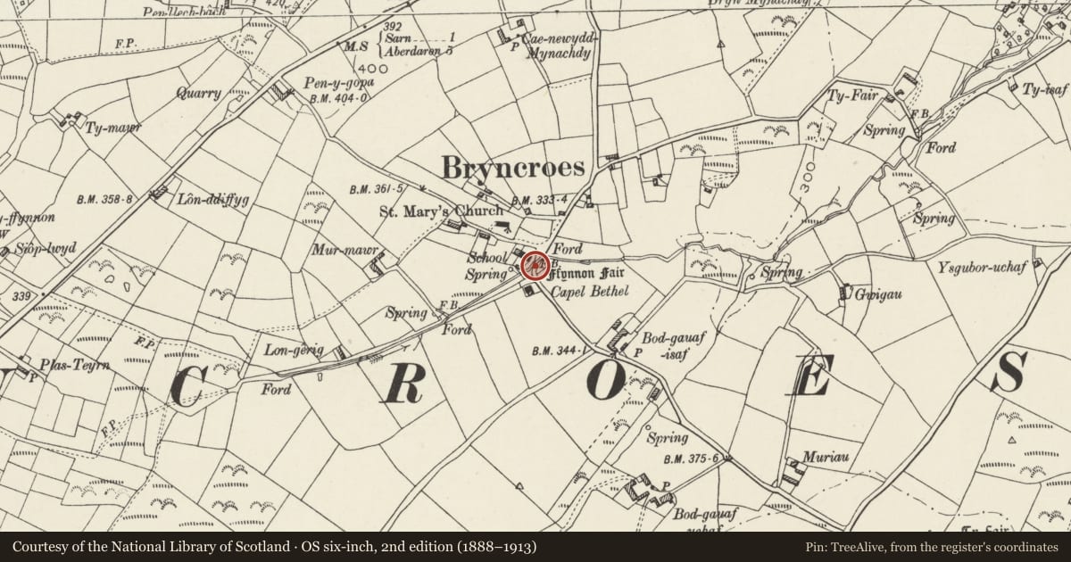
Slide toward Today to fade the historical sheet and see the modern map underneath.
David Rumsey Map Collection, Stanford LibrariesDavid Rumsey Map Collection, Stanford LibrariesDavid Rumsey Map Collection, Stanford LibrariesDavid Rumsey Map Collection, Stanford LibrariesDavid Rumsey Map Collection, Stanford Libraries
5 historical maps cover this location, the earliest the 1608 map "(13) Cambriae Typus." (David Rumsey Map Collection, Stanford Libraries).
Historical maps covering this location
- 1608 · (13) Cambriae Typus. (David Rumsey Map Collection, Stanford Libraries)
- 1830 · V.3:11-15:XV. Britisches Reich. A. Kon: England. b. Frstenthum Wales: Shire: 37-40 (David Rumsey Map Collection, Stanford Libraries)
- 1883 · Watershed map England, Wales 3. (David Rumsey Map Collection, Stanford Libraries)
- 1899 · 134 Pwllheli (Hills) (David Rumsey Map Collection, Stanford Libraries)
- 1901 · Sheet 9 and 10. (David Rumsey Map Collection, Stanford Libraries)
Cadw's description
Location
Beside water meadows, some 50m S of the cross-roads in the centre of Bryncroes village.
History
An ancient spring reputed to have been used as a holy well in medieval times, possibly by monks on the pilgrimage route to Bardsey Island.
Exterior
A mortared wall of squared rubble stone with entrance to E, encloses a space some 2.5m square. Inside this enclosure the stone paving descends in two tiered stages forming a pavement around the perimeter of the pool, which measures some 1.2m square. A run-off channel carries surplus water under the boundary wall to the nearby brook.
To the N of the well enclosure is a small bridge. Two water channels cut diagonally across the roadway. Large crudely-worked boulder forms centre support with rectangular openings with slab lintels on either side. Both sides of roadway flanked by low stone wall with raked copings, which curves at the approaches and continues at SW end to join well enclosure to S.
Reason for designation
Included as a well-preserved, solidly constructed holy well which, with the adjoining bridge, forms a prominent feature in the centre of Bryncroes village.
Nearby in the register
- Church of St MaryReligious, Ritual and Funeraryunder 1 mi
- LettyDomesticunder 1 mi
- Capel Ty MawrReligious, Ritual and Funeraryunder 1 mi
- Salem ChapelReligious, Ritual and Funeraryunder 1 mi
Other entries of the same register within about three miles of this one, by straight line.