Cof Cymru: National Historic Assets of Wales · Wales
Ty'n-y-graig
Aberdaron, Gwynedd, Wales
A Grade II* listed building in Rhiw, Pwllheli, Aberdaron, Gwynedd, designated on 19 October 1971.
The record
- Designation
- Listed building, Grade II*
- Broad class
- Domestic
- Date of designation
- 19 October 1971
- Locality
- Rhiw
- Town
- Pwllheli
- Community
- Aberdaron
- Unitary authority
- Gwynedd
- Country
- Wales
- Coordinates
- 52.82542, -4.62058
- Cadw reference
- 4240
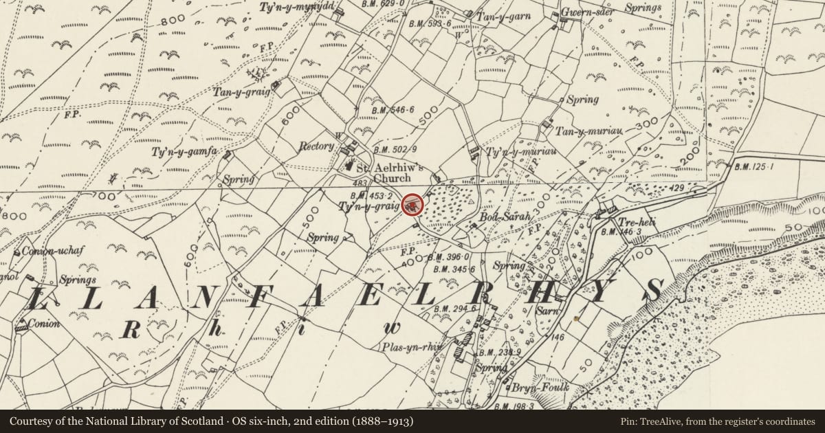
Slide toward Today to fade the historical sheet and see the modern map underneath.
David Rumsey Map Collection, Stanford LibrariesDavid Rumsey Map Collection, Stanford LibrariesDavid Rumsey Map Collection, Stanford LibrariesDavid Rumsey Map Collection, Stanford LibrariesDavid Rumsey Map Collection, Stanford Libraries
5 historical maps cover this location, the earliest the 1608 map "(13) Cambriae Typus." (David Rumsey Map Collection, Stanford Libraries).
Historical maps covering this location
- 1608 · (13) Cambriae Typus. (David Rumsey Map Collection, Stanford Libraries)
- 1830 · V.3:11-15:XV. Britisches Reich. A. Kon: England. b. Frstenthum Wales: Shire: 37-40 (David Rumsey Map Collection, Stanford Libraries)
- 1883 · Watershed map England, Wales 3. (David Rumsey Map Collection, Stanford Libraries)
- 1899 · 134 Pwllheli (Hills) (David Rumsey Map Collection, Stanford Libraries)
- 1901 · Sheet 9 and 10. (David Rumsey Map Collection, Stanford Libraries)
Cadw's description
Location
On the NE side of a lane running past Plas-yn-Rhiw to the Church of St Aelrhiw, some 1km E of Rhiw village.
History
Farmhouse probably earlier C18 but dated WWI 1762 on E wall, the initials for William Williams of Plas yn Rhiw. Marked on 1842 Rhiw Tithe Map as Graig, owned by the Plas-yn-Rhiw estate, occupied by David Evans, with 14 acres (5.6ha).
Exterior
Farmhouse, rubble stone, formerly whitewashed with close-eaved grouted slate roofs and large square stone stack on ridge towards N end, smaller S end square stack, both with dripstones and pyramid capping. Stone coping to gables. One and a half storeys with stair gable projecting centre right on W side. N end is built into slope with loft door. E front is mostly outshut with door at right end into room under loft, behind stack, and then window of 25 very small panes. To left of outshut is cobbled walled yard with door in porch with slate lean-to roof against outshut end wall and stone S wall. Small 4-pane sash in stone eaves-breaking dormer above to left. Lean-to on S end with E door and window. 'WWI 1762' said to be inscribed on E wall. W rear wall, to road, has one 4-pane stair-light in projecting gable, 4-pane sash to ground floor to right of gable, small 4-pane sash just left of gable with eaves-breaking 4-pane sash above in stone dormer gable. At left another small 4-pane ground floor window, to dairy under loft, at slightly higher level.
Interior
Not available for inspection but said to have S end room divided from entry by partition with some in-and-out boarding. Stone stairs opposite entry. Wide-boarded doors, hewn beam and stop chamfered joists.
Reason for designation
Listed Grade II* as a rare C18 substantial vernacular farmhouse.
Nearby in the register
- Church of St AelrhiwReligious, Ritual and Funeraryunder 1 mi
- Ffynnon AelrhiwWater Supply and Drainageunder 1 mi
- Outbuilding NE of Old RectoryDomesticunder 1 mi
- Outbuilding further NE of Old RectoryDomesticunder 1 mi
Other entries of the same register within about three miles of this one, by straight line.