Cof Cymru: National Historic Assets of Wales · Wales
2
Holywell, Flintshire, Wales
A Grade II listed building in Holywell, Flintshire, designated on 19 August 1991.
The record
- Designation
- Listed building, Grade II
- Broad class
- Commercial
- Date of designation
- 19 August 1991
- Community
- Holywell
- Unitary authority
- Flintshire
- Country
- Wales
- Coordinates
- 53.27433, -3.22334
- Cadw reference
- 422
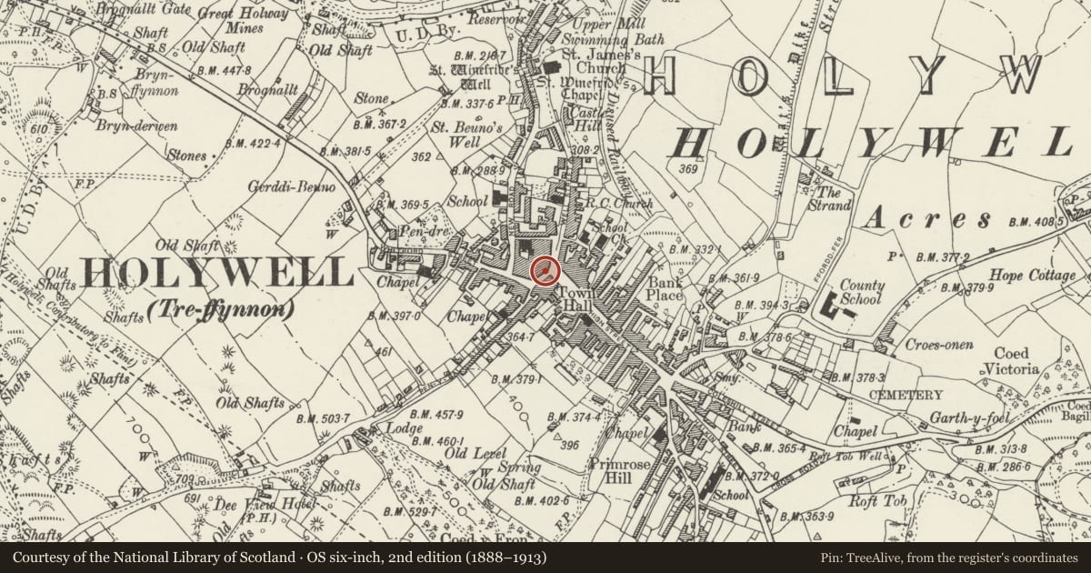
Slide toward Today to fade the historical sheet and see the modern map underneath.
David Rumsey Map Collection, Stanford LibrariesDavid Rumsey Map Collection, Stanford LibrariesDavid Rumsey Map Collection, Stanford LibrariesLlyfrgell Genedlaethol Cymru – The National Library of WalesDavid Rumsey Map Collection, Stanford Libraries
5 historical maps cover this location, the earliest the 1795 map "To Sir Watkin Williams-Wynn Bart ... the map of the six counties of North Wales is most humbly inscribed by his obedient humble servant" (Llyfrgell Genedlaethol Cymru – The National Library of Wales).
Historical maps covering this location
- 1795 · To Sir Watkin Williams-Wynn Bart ... the map of the six counties of North Wales is most… (Llyfrgell Genedlaethol Cymru – The National Library of Wales)
- 1830 · V.3:11-15:XV. Britisches Reich. A. Kon: England. b. Frstenthum Wales: Shire: 37-40 (David Rumsey Map Collection, Stanford Libraries)
- 1883 · Watershed map England, Wales 3. (David Rumsey Map Collection, Stanford Libraries)
- 1896 · 96 Liverpool (Hills) (David Rumsey Map Collection, Stanford Libraries)
- 1901 · Sheet 9 and 10. (David Rumsey Map Collection, Stanford Libraries)
Cadw's description
Location
Prominently sited facing SE along the High Street.
Exterior
Late-Georgian; 3-storey scribed render fronts with parapets. Buildings shown on site on 1833 map; old photographs show that the 4+2-window block to right (formerly known as Scotcher's) was refronted between ca 1850 and 1877 and that the 2-window part to the left was refronted between 1877 and ca 1900.
Small-pane sash windows, horned to left; lintel. The right hand part is distinctive for its high parapet and band courses with bosses; photograph of ca 1900 shows that parapets were continuous. Modern shop fronts and rear.
Reason for designation
Included for the important townscape value of the facades closing the NW end of the High Street and grouping with listed items in Cross Street, High Street and Well Street.
Nearby in the register
- 2ACommercialunder 1 mi
- 1ACommercialunder 1 mi
- 1Commercialunder 1 mi
- 2Commercialunder 1 mi
Other entries of the same register within about three miles of this one, by straight line.