Cof Cymru: National Historic Assets of Wales · Wales
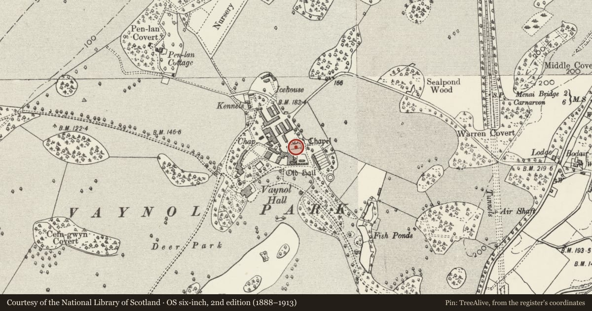
Terraced Garden to N of Vaynol Old Hall
Pentir, Gwynedd, Wales
A Grade II* listed building in Vaynol Park, Bangor, Pentir, Gwynedd, designated on 26 August 1992.
The record
- Designation
- Listed building, Grade II*
- Broad class
- Gardens, Parks and Urban Spaces
- Date of designation
- 26 August 1992
- Locality
- Vaynol Park
- Town
- Bangor
- Community
- Pentir
- Unitary authority
- Gwynedd
- Country
- Wales
- Coordinates
- 53.20298, -4.18965
- Cadw reference
- 4169
Slide toward Today to fade the historical sheet and see the modern map underneath.
David Rumsey Map Collection, Stanford LibrariesDavid Rumsey Map Collection, Stanford LibrariesDavid Rumsey Map Collection, Stanford LibrariesDavid Rumsey Map Collection, Stanford LibrariesDavid Rumsey Map Collection, Stanford Libraries
5 historical maps cover this location, the earliest the 1896 map "Sheet 7. Ordnance Survey of England and Wales." (David Rumsey Map Collection, Stanford Libraries).
Historical maps covering this location
- 1896 · Sheet 7. Ordnance Survey of England and Wales. (David Rumsey Map Collection, Stanford Libraries)
- 1899 · 106 Bangor (Outline) (David Rumsey Map Collection, Stanford Libraries)
- 1899 · 106 Bangor (Hills) (David Rumsey Map Collection, Stanford Libraries)
- 1901 · Sheet 9 and 10. (David Rumsey Map Collection, Stanford Libraries)
- 1919 · Sheet 41. Anglesey. (David Rumsey Map Collection, Stanford Libraries)
Cadw's description
Location
Laid out immediately N of the front driveway to Vaynol Old Hall. Its N end borders the walled garden to the rear of Dairy Cottage.
History
In the medieval period, Vaynol was part of the episcopal estate of the Bishops of Bangor. After the dissolution, it came into the Williams family of Cochwillan and elsewhere, passing out of their hands after the last of the Williams family died without issue in 1696. The garden appears to have been laid out contemporaneously with work on the Old Hall in the early to mid C17.
Exterior
Walled and terraced garden in a late medieval-early Renaissance style, rising from S to N away from the front of the Old Hall, and bounded on 3 sides by tall rubble stone walls. Axial rounded steps, lead to a narrow cross walk which has the private chapel at the W end, and from which squared steps lead to the next level. In the upper section of the garden there is a circular pond, set at the node point of a wide bow in the upper wall, and at the centre of which is the 'gateway with inscriptions', giving access to the next walled garden at the rear of the later Dairy Cottage.
Reason for designation
Graded II* as an especially well preserved and important example of a C16 or early C17 terraced garden of a type which very rarely survives in anything like a recognisable form. Also listed for its setting in front of the fine Grade I listed Vaynol Old Hall.
Nearby in the register
- Classical bust on stele in niche of garden wall at Vaynol Old Hall.Gardens, Parks and Urban Spacesunder 1 mi
- Gateway with inscription set in N boundary wall of Terrace Garden opposite Vaynol Old HallGardens, Parks and Urban Spacesunder 1 mi
- Arched wall to forecourt of Vaynol Old HallGardens, Parks and Urban Spacesunder 1 mi
- Chapel of St Mary to N of Vaynol Old HallReligious, Ritual and Funeraryunder 1 mi
Other entries of the same register within about three miles of this one, by straight line.