Cof Cymru: National Historic Assets of Wales · Wales
Barnardo's
Bangor, Gwynedd, Wales
A Grade II listed building in Bangor, Gwynedd, designated on 17 April 1980.
The record
- Designation
- Listed building, Grade II
- Broad class
- Commercial
- Date of designation
- 17 April 1980
- Community
- Bangor
- Unitary authority
- Gwynedd
- Country
- Wales
- Coordinates
- 53.22728, -4.12609
- Cadw reference
- 4127
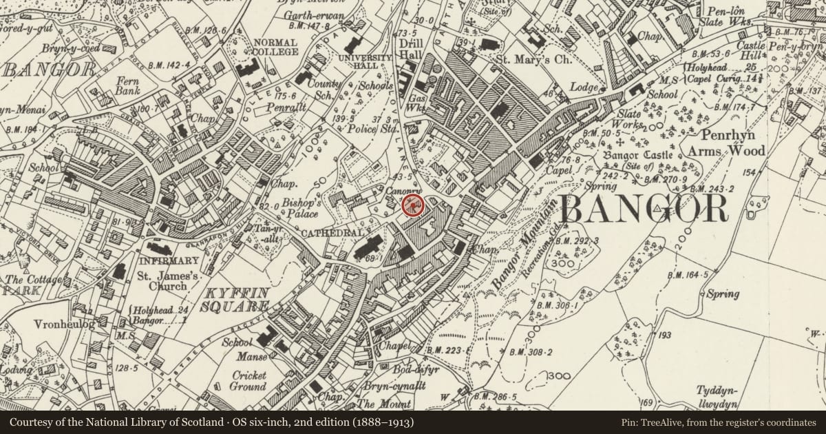
Slide toward Today to fade the historical sheet and see the modern map underneath.
David Rumsey Map Collection, Stanford LibrariesDavid Rumsey Map Collection, Stanford LibrariesDavid Rumsey Map Collection, Stanford LibrariesDavid Rumsey Map Collection, Stanford LibrariesDavid Rumsey Map Collection, Stanford Libraries
5 historical maps cover this location, the earliest the 1896 map "Sheet 7. Ordnance Survey of England and Wales." (David Rumsey Map Collection, Stanford Libraries).
Historical maps covering this location
- 1896 · Sheet 7. Ordnance Survey of England and Wales. (David Rumsey Map Collection, Stanford Libraries)
- 1899 · 106 Bangor (Outline) (David Rumsey Map Collection, Stanford Libraries)
- 1899 · 106 Bangor (Hills) (David Rumsey Map Collection, Stanford Libraries)
- 1901 · Sheet 9 and 10. (David Rumsey Map Collection, Stanford Libraries)
- 1919 · Sheet 41. Anglesey. (David Rumsey Map Collection, Stanford Libraries)
Cadw's description
Location
Stepped down between Llys Gwynedd and Penrhyn Hall.
History
Early C19; shown on John Wood’s 1834 map.
Exterior
2-storey 4-window stucco front with slate roof. 12-pane sash windows to 1st floor; later shop windows to either end (modern to left) with splayed entrances. Square headed through ‘carriageway’ beside arched opening formerly with reused 6-pane fanlight. Alterations and modern extensions to rear under construction at the time of inspection (Autumn 1987).
Reason for designation
Group value with Penrhyn Hall and Llys Gwynedd.
Nearby in the register
- Gledhill'sCommercialunder 1 mi
- Penrhyn HallCommercialunder 1 mi
- Lly's GwyneddDomesticunder 1 mi
- Bangor Museum & Art Gallery, including outbuilding at NW endRecreationalunder 1 mi
Other entries of the same register within about three miles of this one, by straight line.