Cof Cymru: National Historic Assets of Wales · Wales
E.T.& J.Dogan & Sons
Bangor, Gwynedd, Wales
A Grade II listed building in Bangor, Gwynedd, designated on 2 August 1988.
The record
- Designation
- Listed building, Grade II
- Broad class
- Commercial
- Date of designation
- 2 August 1988
- Community
- Bangor
- Unitary authority
- Gwynedd
- Country
- Wales
- Coordinates
- 53.22886, -4.12166
- Cadw reference
- 4042
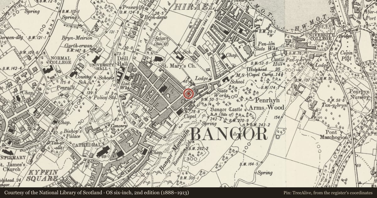
Slide toward Today to fade the historical sheet and see the modern map underneath.
David Rumsey Map Collection, Stanford LibrariesDavid Rumsey Map Collection, Stanford LibrariesDavid Rumsey Map Collection, Stanford LibrariesDavid Rumsey Map Collection, Stanford LibrariesDavid Rumsey Map Collection, Stanford Libraries
5 historical maps cover this location, the earliest the 1896 map "Sheet 7. Ordnance Survey of England and Wales." (David Rumsey Map Collection, Stanford Libraries).
Historical maps covering this location
- 1896 · Sheet 7. Ordnance Survey of England and Wales. (David Rumsey Map Collection, Stanford Libraries)
- 1899 · 106 Bangor (Outline) (David Rumsey Map Collection, Stanford Libraries)
- 1899 · 106 Bangor (Hills) (David Rumsey Map Collection, Stanford Libraries)
- 1901 · Sheet 9 and 10. (David Rumsey Map Collection, Stanford Libraries)
- 1919 · Sheet 41. Anglesey. (David Rumsey Map Collection, Stanford Libraries)
Cadw's description
Location
Set into a row of frontages towards the N end of the street. Formerly known together as Warwick House and is said to have been a PH.
History
Ca 1800.
Exterior
Group of 3-storey, 2-window roughcast, pebbledash and scribed rendered fronts. Undulating old slate roofs; rendered chimney stack to right end and rubble and brick stack to left end. Small pane sash windows of varied proportions; No 354 has architraves, cill and lintel bands. Victorian shop front to No 352 with fascia end brackets, panelled pilasters, colonettes and foliage trail band over splayed entrance with half glazed door. Altered shop front to No 354; panelled end pilasters and 4-panel door in splayed entrance retained. No 356 retains 6-panel shop window with framing panelled pilasters and cornice; 6-panel and half glazed doors to left both with overlights.
Various sash windows to rear; lower brick cross range to Nos 352 and 354 has been half demolished. Renewed roof to No 352; semi-derelict rear to No 354.
Nearby in the register
- Cefni Fruit Co.Commercialunder 1 mi
- Fish & Chip BarCommercialunder 1 mi
- Ye Olde Vaults P.H.Commercialunder 1 mi
- Friar's TerraceDomesticunder 1 mi
Other entries of the same register within about three miles of this one, by straight line.