Cof Cymru: National Historic Assets of Wales · Wales
Oliver's
Bangor, Gwynedd, Wales
A Grade II listed building in Bangor, Gwynedd, designated on 2 August 1988.
The record
- Designation
- Listed building, Grade II
- Broad class
- Commercial
- Date of designation
- 2 August 1988
- Community
- Bangor
- Unitary authority
- Gwynedd
- Country
- Wales
- Coordinates
- 53.22671, -4.12495
- Cadw reference
- 4037
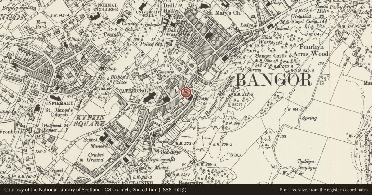
Slide toward Today to fade the historical sheet and see the modern map underneath.
David Rumsey Map Collection, Stanford LibrariesDavid Rumsey Map Collection, Stanford LibrariesDavid Rumsey Map Collection, Stanford LibrariesDavid Rumsey Map Collection, Stanford LibrariesDavid Rumsey Map Collection, Stanford Libraries
5 historical maps cover this location, the earliest the 1896 map "Sheet 7. Ordnance Survey of England and Wales." (David Rumsey Map Collection, Stanford Libraries).
Historical maps covering this location
- 1896 · Sheet 7. Ordnance Survey of England and Wales. (David Rumsey Map Collection, Stanford Libraries)
- 1899 · 106 Bangor (Outline) (David Rumsey Map Collection, Stanford Libraries)
- 1899 · 106 Bangor (Hills) (David Rumsey Map Collection, Stanford Libraries)
- 1901 · Sheet 9 and 10. (David Rumsey Map Collection, Stanford Libraries)
- 1919 · Sheet 41. Anglesey. (David Rumsey Map Collection, Stanford Libraries)
Cadw's description
Location
Detached group on the bend between New Ebenezer Place and York Place.
History
Late Georgian group shown on John Wood’s 1834 map.
Exterior
3-storey, 2-window fronts, Nos 252 and 254 are colourwashed coursed rubble and No 256 is scribed rendered. Slate roofs, cement rendered chimney stacks with stone caps and later dormer window to No 254. Mostly 12-pane sash windows with cills, glazing bars removed to 1st floor lower sashes of Nos 254 and 256. Altered and modern shop fronts; that to No 252 has broadly splayed entrance and glazed tiling, pilasters to No 254 with 6-panel door and panelled reveals to offices over shop.
Scribed render right end with small pane sash window, also to attached 2-storey cross range set in the slope of New Ebenezer Place. Rendered left end with round arched headed window to the gable, formed of twinned 12-pane sashes under a fanlight; further sash windows below.
Stepped rear with No 256 extending the furthest; Nos 252 and 256 are rendered, No 254 is rubble; small pane sash windows. Modern extensions are not included.
Reason for designation
Group value with National Westminster Bank, opposite.
Nearby in the register
- The Coffee PotCommercialunder 1 mi
- J.Welch & Co.Commercialunder 1 mi
- Ebenezer Congregationalist ChapelReligious, Ritual and Funeraryunder 1 mi
- National Westminster BankCommercialunder 1 mi
Other entries of the same register within about three miles of this one, by straight line.