Cof Cymru: National Historic Assets of Wales · Wales
93 High Street
Bangor, Gwynedd, Wales
A Grade II listed building in Bangor, Gwynedd, designated on 24 July 1979.
The record
- Designation
- Listed building, Grade II
- Broad class
- Domestic
- Date of designation
- 24 July 1979
- Community
- Bangor
- Unitary authority
- Gwynedd
- Country
- Wales
- Coordinates
- 53.22417, -4.12940
- Cadw reference
- 4021
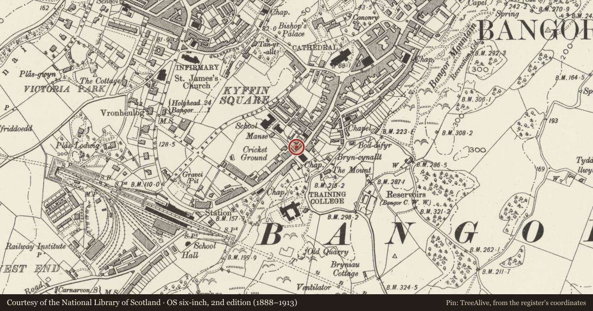
Slide toward Today to fade the historical sheet and see the modern map underneath.
David Rumsey Map Collection, Stanford LibrariesDavid Rumsey Map Collection, Stanford LibrariesDavid Rumsey Map Collection, Stanford LibrariesDavid Rumsey Map Collection, Stanford LibrariesDavid Rumsey Map Collection, Stanford Libraries
5 historical maps cover this location, the earliest the 1896 map "Sheet 7. Ordnance Survey of England and Wales." (David Rumsey Map Collection, Stanford Libraries).
Historical maps covering this location
- 1896 · Sheet 7. Ordnance Survey of England and Wales. (David Rumsey Map Collection, Stanford Libraries)
- 1899 · 106 Bangor (Outline) (David Rumsey Map Collection, Stanford Libraries)
- 1899 · 106 Bangor (Hills) (David Rumsey Map Collection, Stanford Libraries)
- 1901 · Sheet 9 and 10. (David Rumsey Map Collection, Stanford Libraries)
- 1919 · Sheet 41. Anglesey. (David Rumsey Map Collection, Stanford Libraries)
Cadw's description
Location
Below the road, detached to left.
History
Early C19.
Exterior
Pair of 2-storey pebbledash fronts. Slate roofs with dividing parapet and red brick chimney stacks (truncated to left); skylights to left. 3-window front to No93 and 2-windows to No 95. Central 6-panel door to No 93 with 16-pane sash windows to 1st floor and 4-pane below. Modern door to No 95 with 12-pane sash 1st floor windows and tripartite modern ground floor window. Pebbledash left end and part colourwashed rubble rear with modern windows.
Nearby in the register
- 95 High StreetDomesticunder 1 mi
- Pendref ChapelReligious, Ritual and Funeraryunder 1 mi
- The Harp Inn PH including attached former outbuildings (78-82 Even nos)Domesticunder 1 mi
- BrynynalltDomesticunder 1 mi
Other entries of the same register within about three miles of this one, by straight line.