Cof Cymru: National Historic Assets of Wales · Wales
5 Fron Dirion Terrace
Bangor, Gwynedd, Wales
A Grade II listed building in Glanrafon Hill, Bangor, Gwynedd, designated on 2 August 1988.
The record
- Designation
- Listed building, Grade II
- Broad class
- Domestic
- Date of designation
- 2 August 1988
- Locality
- Glanrafon Hill
- Community
- Bangor
- Unitary authority
- Gwynedd
- Country
- Wales
- Coordinates
- 53.22689, -4.13242
- Cadw reference
- 4012
Slide toward Today to fade the historical sheet and see the modern map underneath.
David Rumsey Map Collection, Stanford LibrariesDavid Rumsey Map Collection, Stanford LibrariesDavid Rumsey Map Collection, Stanford LibrariesDavid Rumsey Map Collection, Stanford LibrariesDavid Rumsey Map Collection, Stanford Libraries
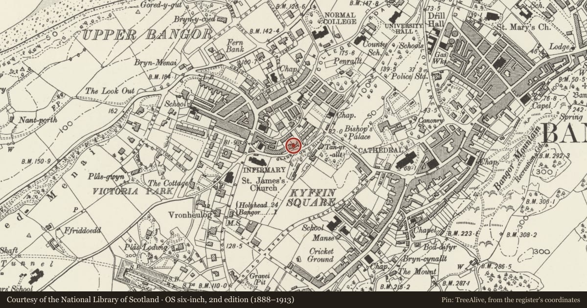
5 historical maps cover this location, the earliest the 1896 map "Sheet 7. Ordnance Survey of England and Wales." (David Rumsey Map Collection, Stanford Libraries).
Historical maps covering this location
- 1896 · Sheet 7. Ordnance Survey of England and Wales. (David Rumsey Map Collection, Stanford Libraries)
- 1899 · 106 Bangor (Outline) (David Rumsey Map Collection, Stanford Libraries)
- 1899 · 106 Bangor (Hills) (David Rumsey Map Collection, Stanford Libraries)
- 1901 · Sheet 9 and 10. (David Rumsey Map Collection, Stanford Libraries)
- 1919 · Sheet 41. Anglesey. (David Rumsey Map Collection, Stanford Libraries)
Cadw's description
Location
Set in the slope above Nos 1 to 3; detached. Gardens to the front with rubble forecourt walls; iron railings retained to No 4.
History
Shown on Captain Johnson’s 1854 map.
Exterior
Pair of 2-storey, 2-window scribed render fronts with 1st floor cill band and plinth. Slate roof and rendered chimney stack to left. Sash windows with marginal glazing bars and Tudor labels. No 4 retains twin-arched panelled door. Slate hung left gable end with 4-pane sash. Small pane sashes to rear and cross ranges, partly slate hung and jetted to No 5. Narrow passage to left of No 5 is bridged at 1st floor level to connect with No 6.
Reason for designation
Included for group value with neighbouring terraces on Glanrafon Hill
Nearby in the register
- 4 Fron Dirion TerraceDomesticunder 1 mi
- 6 Fron Dirion TerraceDomesticunder 1 mi
- 7 Fron Dirion TerraceDomesticunder 1 mi
- 3 Fron Dirion TerraceDomesticunder 1 mi
Other entries of the same register within about three miles of this one, by straight line.