Cof Cymru: National Historic Assets of Wales · Wales
Main Entrance to Normal College, attached Boundary Walls & entrance to Athroly's and Neuadd John Phi
Bangor, Gwynedd, Wales
A Grade II listed building in Bangor, Gwynedd, designated on 17 April 1980.
The record
- Designation
- Listed building, Grade II
- Broad class
- Domestic
- Date of designation
- 17 April 1980
- Community
- Bangor
- Unitary authority
- Gwynedd
- Country
- Wales
- Coordinates
- 53.23005, -4.12954
- Cadw reference
- 3956
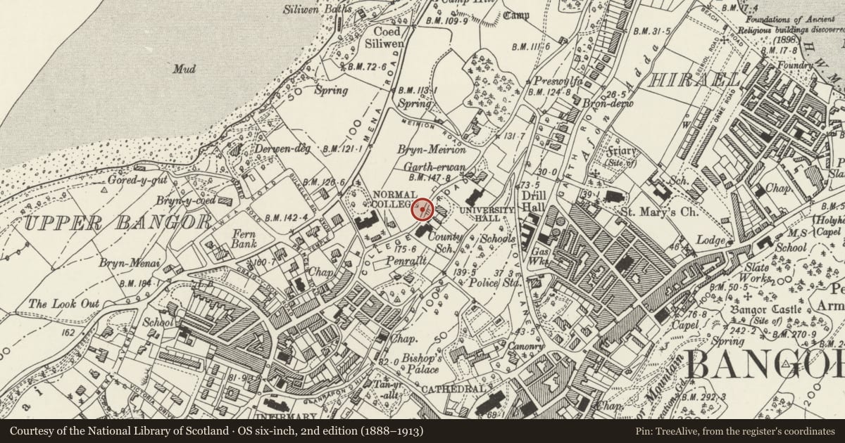
Slide toward Today to fade the historical sheet and see the modern map underneath.
David Rumsey Map Collection, Stanford LibrariesDavid Rumsey Map Collection, Stanford LibrariesDavid Rumsey Map Collection, Stanford LibrariesDavid Rumsey Map Collection, Stanford LibrariesDavid Rumsey Map Collection, Stanford Libraries
5 historical maps cover this location, the earliest the 1896 map "Sheet 7. Ordnance Survey of England and Wales." (David Rumsey Map Collection, Stanford Libraries).
Historical maps covering this location
- 1896 · Sheet 7. Ordnance Survey of England and Wales. (David Rumsey Map Collection, Stanford Libraries)
- 1899 · 106 Bangor (Outline) (David Rumsey Map Collection, Stanford Libraries)
- 1899 · 106 Bangor (Hills) (David Rumsey Map Collection, Stanford Libraries)
- 1901 · Sheet 9 and 10. (David Rumsey Map Collection, Stanford Libraries)
- 1919 · Sheet 41. Anglesey. (David Rumsey Map Collection, Stanford Libraries)
Cadw's description
Location
At the roadside; leading into the upper courtyard of the Halls of Residence.
History
Contemporary with the 1910 Halls of Residence and probably also by H T Hare.
Exterior
The set back main entrance to the Normal College has octagonal ashlar gate piers with ball finials over cornices; spurs to bases and stone setts to driveway with double gates. The attached rubble walls with freestone coping form quadrant shaped wings to either side. They are then ramped down to form boundary walls extending to left as far as the entrance to Athrolys, with similar gate piers without cornices and to right as far as the entrance to Neuadd John Phillips again with similar gate piers.
Reason for designation
Group value with Athrolys and neighbouring Normal College buildings.
Nearby in the register
- Athroly's (Normal College)Educationunder 1 mi
- The Normal College (Original Building)Educationunder 1 mi
- Neuadd Alun (Normal College)Educationunder 1 mi
- Pillar Box on Pavement to W of Music Department BuildingCommunicationsunder 1 mi
Other entries of the same register within about three miles of this one, by straight line.