Cof Cymru: National Historic Assets of Wales · Wales
1 Bishop's Close
Bangor, Gwynedd, Wales
A Grade II listed building in Bangor, Gwynedd, designated on 2 August 1988.
The record
- Designation
- Listed building, Grade II
- Broad class
- Domestic
- Date of designation
- 2 August 1988
- Community
- Bangor
- Unitary authority
- Gwynedd
- Country
- Wales
- Coordinates
- 53.22633, -4.12684
- Cadw reference
- 3944
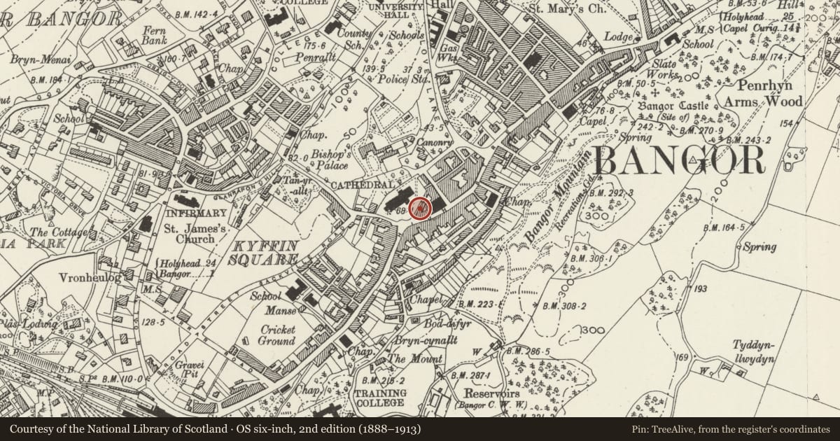
Slide toward Today to fade the historical sheet and see the modern map underneath.
David Rumsey Map Collection, Stanford LibrariesDavid Rumsey Map Collection, Stanford LibrariesDavid Rumsey Map Collection, Stanford LibrariesDavid Rumsey Map Collection, Stanford LibrariesDavid Rumsey Map Collection, Stanford Libraries
5 historical maps cover this location, the earliest the 1896 map "Sheet 7. Ordnance Survey of England and Wales." (David Rumsey Map Collection, Stanford Libraries).
Historical maps covering this location
- 1896 · Sheet 7. Ordnance Survey of England and Wales. (David Rumsey Map Collection, Stanford Libraries)
- 1899 · 106 Bangor (Outline) (David Rumsey Map Collection, Stanford Libraries)
- 1899 · 106 Bangor (Hills) (David Rumsey Map Collection, Stanford Libraries)
- 1901 · Sheet 9 and 10. (David Rumsey Map Collection, Stanford Libraries)
- 1919 · Sheet 41. Anglesey. (David Rumsey Map Collection, Stanford Libraries)
Cadw's description
Location
At the S edge of the Cathedral Churchyard, reached down a path N off the High street.
History
Built in 1805 as almshouses, cost £650; renovated 1960. Established under the Bishop Rowlands Trust and originally known as the Bangor Hospital.
Exterior
Symmetrical, 2-storey, 8-window squared rubble front formed of 2 groups of 3 dwellings; each with advanced and gabled central entrance bays. Slate roof, wide boarded eaves with end and central chimney stacks (2 heightened in brick). Band courses along bases of the steep gables. Small pane (mental frame) casement windows with Tudor labels except over narrower central windows. Pointed arch entrances with voussoirs, boarded doors and ogee headed lights. Rubble gable ends.
Stone screen walls set back at either end, single storey with pointed arched doorways. Spearhead railings extend to right adjoining No 205 High Street.
Reason for designation
Group value with St Deiniol’s Cathedral.
Nearby in the register
- 2 Bishop's CloseDomesticunder 1 mi
- 6 Bishops CloseDomesticunder 1 mi
- 3 Bishop's CloseDomesticunder 1 mi
- 5 Bishops CloseDomesticunder 1 mi
Other entries of the same register within about three miles of this one, by straight line.