Cof Cymru: National Historic Assets of Wales · Wales
Hendre Gaerog
Caernarfon, Gwynedd, Wales
A Grade II listed building in South Road, Caernarfon, Gwynedd, designated on 31 March 1983.
The record
- Designation
- Listed building, Grade II
- Broad class
- Domestic
- Date of designation
- 31 March 1983
- Locality
- South Road
- Town
- Caernarfon
- Community
- Caernarfon
- Unitary authority
- Gwynedd
- Country
- Wales
- Coordinates
- 53.13727, -4.26981
- Cadw reference
- 3917
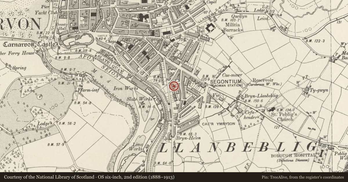
Slide toward Today to fade the historical sheet and see the modern map underneath.
David Rumsey Map Collection, Stanford LibrariesDavid Rumsey Map Collection, Stanford LibrariesDavid Rumsey Map Collection, Stanford LibrariesDavid Rumsey Map Collection, Stanford LibrariesDavid Rumsey Map Collection, Stanford Libraries
5 historical maps cover this location, the earliest the 1883 map "Watershed map England, Wales 3." (David Rumsey Map Collection, Stanford Libraries).
Historical maps covering this location
- 1883 · Watershed map England, Wales 3. (David Rumsey Map Collection, Stanford Libraries)
- 1896 · Sheet 7. Ordnance Survey of England and Wales. (David Rumsey Map Collection, Stanford Libraries)
- 1899 · 105 Carnarvon (Hills) (David Rumsey Map Collection, Stanford Libraries)
- 1901 · Sheet 9 and 10. (David Rumsey Map Collection, Stanford Libraries)
- 1919 · Sheet 41. Anglesey. (David Rumsey Map Collection, Stanford Libraries)
Cadw's description
Location
Set back from the road S of the junction with Constantine Terrace.
History
An early C19 house shown on the 1834 town map. The veranda and canted bay windows are probably later additions, and are first shown on the 1889 Ordnance Survey.
Exterior
A late Georgian house of 2 storeys and 3 bays, of roughcast walls with rusticated quoins, and hipped slate roof on a moulded cornice, with roughcast stacks R and L of centre. In the lower storey is a central door with ribbed panels and neo-classical wrought iron radial-glazed overlight. The outer bays have late C19 canted bay windows with dentil cornice and incorporating 24-pane horned sashes. A lean-to veranda has cast iron posts and wooden arches with pierced spandrels and a replaced glazed roof hipped at the ends. The upper storey has 12-pane horned sash windows in moulded architraves. The L side wall has a 9-pane sash window upper L.
Reason for designation
Listed as a late Georgian suburban house retaining C19 character and detail, and representing the C19 suburban expansion of the town consequent upon Caernarfon's growth in importance as a port.
Nearby in the register
- Boundary wall, railings and gate to Hendre GaerogDomesticunder 1 mi
- Lower Roman FortFortunder 1 mi
- Bron y GaerDomesticunder 1 mi
- Coed y GlynDomesticunder 1 mi
Other entries of the same register within about three miles of this one, by straight line.