Cof Cymru: National Historic Assets of Wales · Wales
67-69 Pool Street
Caernarfon, Gwynedd, Wales
A Grade II listed building in Caernarfon, Gwynedd, designated on 11 September 1976.
The record
- Designation
- Listed building, Grade II
- Broad class
- Commercial
- Date of designation
- 11 September 1976
- Locality
- Caernarfon
- Town
- Caernarfon
- Community
- Caernarfon
- Unitary authority
- Gwynedd
- Country
- Wales
- Coordinates
- 53.13896, -4.27103
- Cadw reference
- 3916
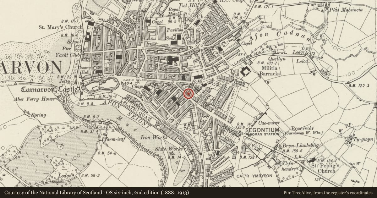
Slide toward Today to fade the historical sheet and see the modern map underneath.
David Rumsey Map Collection, Stanford LibrariesDavid Rumsey Map Collection, Stanford LibrariesDavid Rumsey Map Collection, Stanford LibrariesDavid Rumsey Map Collection, Stanford LibrariesDavid Rumsey Map Collection, Stanford Libraries
5 historical maps cover this location, the earliest the 1883 map "Watershed map England, Wales 3." (David Rumsey Map Collection, Stanford Libraries).
Historical maps covering this location
- 1883 · Watershed map England, Wales 3. (David Rumsey Map Collection, Stanford Libraries)
- 1896 · Sheet 7. Ordnance Survey of England and Wales. (David Rumsey Map Collection, Stanford Libraries)
- 1899 · 105 Carnarvon (Hills) (David Rumsey Map Collection, Stanford Libraries)
- 1901 · Sheet 9 and 10. (David Rumsey Map Collection, Stanford Libraries)
- 1919 · Sheet 41. Anglesey. (David Rumsey Map Collection, Stanford Libraries)
Cadw's description
Location
Set into a row of frontages at the E end of the street.
History
Built in the period 1810-34 and first shown on the 1834 town map. It was altered in the late C19 to the present polygonal plan, which is first shown on the 1888 Ordnance Survey. It was a grocer's shop in 1895.
Exterior
A 2-storey shop with dwelling above, with polygonal block at the R end, of whitened rendered walls but retaining traces of former scribed roughcast, and slate roof with reduced stack at the L end. A boarded door offset to the R side of the lower range is flanked by inserted large shop windows. In the upper storey is a 2-pane sash to the L. The R-hand polygonal portion is higher, under a pyramidal roof, and has a 4-pane sash window to the upper storey. The rear has replaced windows.
Reason for designation
Listed for its C19 character and for its contribution to a group of well-preserved but humbler C19 urban buildings at the SE end of Pool Street.
Nearby in the register
- 65 Pool StreetDomesticunder 1 mi
- 56 Pool StreetDomesticunder 1 mi
- 54 Pool StreetCommercialunder 1 mi
- 28 Garnon StreetDomesticunder 1 mi
Other entries of the same register within about three miles of this one, by straight line.