Cof Cymru: National Historic Assets of Wales · Wales
Gwellyn
Caernarfon, Gwynedd, Wales
A Grade II listed building in Caernarfon, Gwynedd, designated on 31 March 1983.
The record
- Designation
- Listed building, Grade II
- Broad class
- Domestic
- Date of designation
- 31 March 1983
- Locality
- Caernarfon
- Town
- Caernarfon
- Community
- Caernarfon
- Unitary authority
- Gwynedd
- Country
- Wales
- Coordinates
- 53.14080, -4.26533
- Cadw reference
- 3888
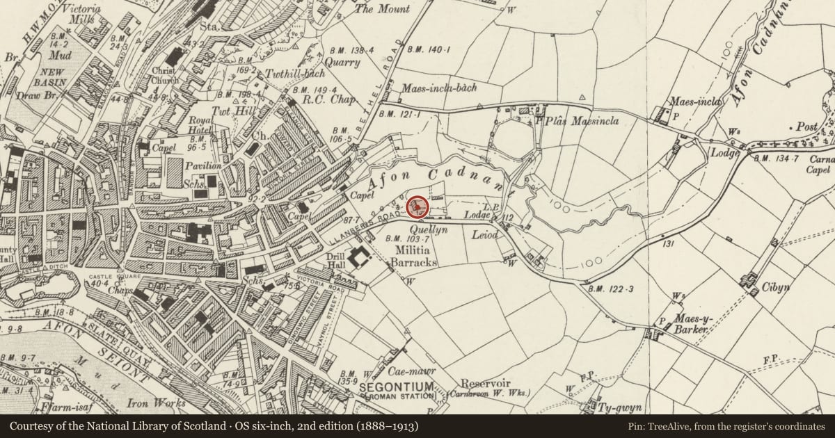
Slide toward Today to fade the historical sheet and see the modern map underneath.
David Rumsey Map Collection, Stanford LibrariesDavid Rumsey Map Collection, Stanford LibrariesDavid Rumsey Map Collection, Stanford LibrariesDavid Rumsey Map Collection, Stanford LibrariesDavid Rumsey Map Collection, Stanford Libraries
5 historical maps cover this location, the earliest the 1883 map "Watershed map England, Wales 3." (David Rumsey Map Collection, Stanford Libraries).
Historical maps covering this location
- 1883 · Watershed map England, Wales 3. (David Rumsey Map Collection, Stanford Libraries)
- 1896 · Sheet 7. Ordnance Survey of England and Wales. (David Rumsey Map Collection, Stanford Libraries)
- 1899 · 105 Carnarvon (Hills) (David Rumsey Map Collection, Stanford Libraries)
- 1901 · Sheet 9 and 10. (David Rumsey Map Collection, Stanford Libraries)
- 1919 · Sheet 41. Anglesey. (David Rumsey Map Collection, Stanford Libraries)
Cadw's description
Location
Set back from the road behind a walled forecourt and reached from the W side through the grounds of the Magistrate's Court.
History
Built in the early C19 and shown on the 1834 town plan. Converted to flats in the late C20.
Exterior
Regency house of 2 storeys with attic, and 4 bays. Rendered with slate roof on bracketed eaves, and with 2 ridge stacks. A rear wing, giving the house an L-shaped plan, probably housed the service rooms. Symmetrically arranged, with shallow bow to central bays and gabled wider outer bays. Central entrance in advanced gabled porch flanked by continuous veranda with hipped slate roof carried on corner posts. 12-pane sashes flank the porch on each floor, and there are similar windows in the outer bays on each floor, paired to the left hand gable. The shallow gables have, to left and right, an oculus and a small round headed window. The rear of the main house has sash windows to the R and blocked windows to the L.
Interior
Modernised and converted to flats.
Reason for designation
Listed as a late Georgian house retaining early character and representing the suburban expansion of the town when the development of its port saw growing commercial prosperity in Caernarfon.
Nearby in the register
- The BarracksDefenceunder 1 mi
- 12 Holywell TerraceDomesticunder 1 mi
- 10 Holywell TerraceDomesticunder 1 mi
- 8 Holywell TerraceDomesticunder 1 mi
Other entries of the same register within about three miles of this one, by straight line.