Cof Cymru: National Historic Assets of Wales · Wales
14 High Street
Caernarfon, Gwynedd, Wales
A Grade II listed building in Walled town, Caernarfon, Gwynedd, designated on 22 May 1967.
The record
- Designation
- Listed building, Grade II
- Broad class
- Domestic
- Date of designation
- 22 May 1967
- Locality
- Walled town
- Town
- Caernarfon
- Community
- Caernarfon
- Unitary authority
- Gwynedd
- Country
- Wales
- Coordinates
- 53.14063, -4.27714
- Cadw reference
- 3872
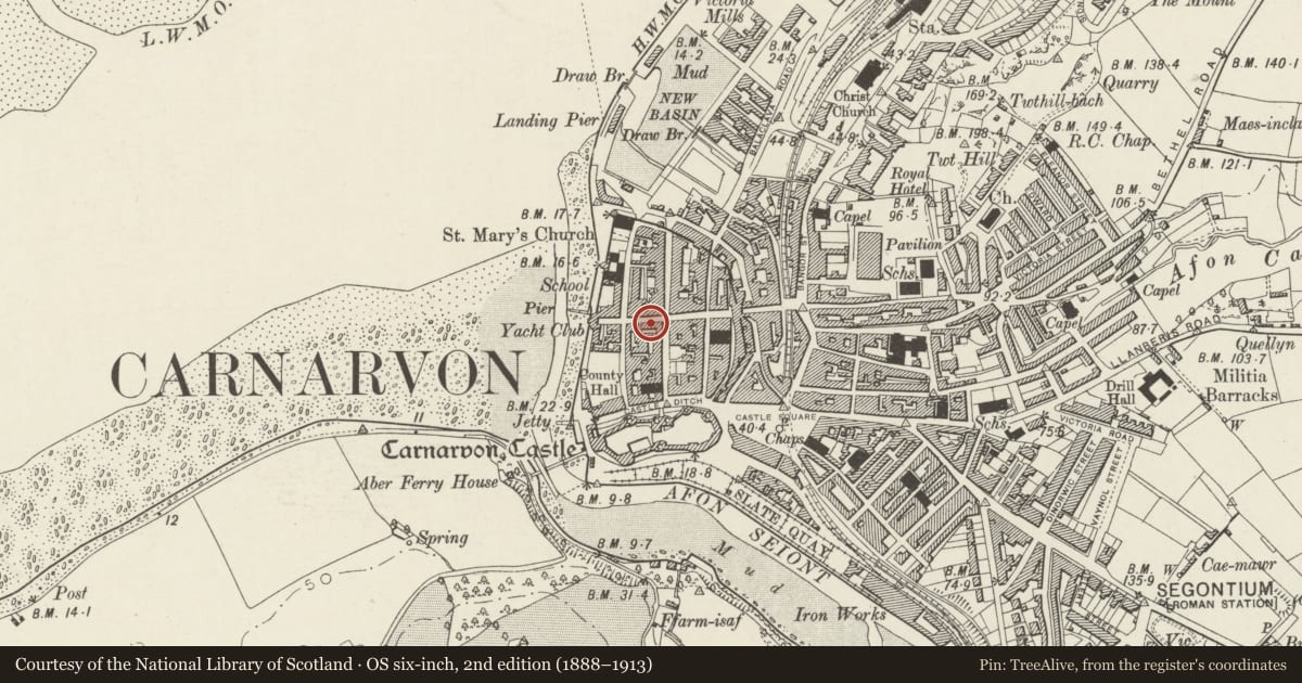
Slide toward Today to fade the historical sheet and see the modern map underneath.
David Rumsey Map Collection, Stanford LibrariesDavid Rumsey Map Collection, Stanford LibrariesDavid Rumsey Map Collection, Stanford LibrariesDavid Rumsey Map Collection, Stanford LibrariesDavid Rumsey Map Collection, Stanford Libraries
5 historical maps cover this location, the earliest the 1883 map "Watershed map England, Wales 3." (David Rumsey Map Collection, Stanford Libraries).
Historical maps covering this location
- 1883 · Watershed map England, Wales 3. (David Rumsey Map Collection, Stanford Libraries)
- 1896 · Sheet 7. Ordnance Survey of England and Wales. (David Rumsey Map Collection, Stanford Libraries)
- 1899 · 105 Carnarvon (Hills) (David Rumsey Map Collection, Stanford Libraries)
- 1901 · Sheet 9 and 10. (David Rumsey Map Collection, Stanford Libraries)
- 1919 · Sheet 41. Anglesey. (David Rumsey Map Collection, Stanford Libraries)
Cadw's description
Location
In a row of frontages near the W end of the street.
History
Originally a single building with No 12 and shown on the 1834 town map, but the front is a remodelling of the late C19. It was a printer's in 1895.
Exterior
3 story, 3 windowed house and shop, roughcast front wall and slate roof on a moulded eaves cornice. Openings have mainly late C19 eared and lugged architraves with keystones. The central doorway has a replaced fielded panel door and small-pane overlight. To its L is an inserted tripartite small-pane horned sash window. On the R side is an early C19 small-pane bow shop window on 2 wooden brackets and in a simple panelled surround. In the middle storey are 12-pane hornless sash windows with sill band, while in the upper storey are 9-pane sash windows in architraves without keystones.
The single-window rear elevation is rubble stone, with small-pane horned sash windows under segmental brick heads, and a boarded door to the L.
Reason for designation
Listed for its C19 character and detail, including a rare surviving early C19 shop window, and for its contribution to the historic integrity of the walled town.
Nearby in the register
- Ty SidanDomesticunder 1 mi
- Hafod AurDomesticunder 1 mi
- Castle HouseDomesticunder 1 mi
- 2 Castle StreetCommercialunder 1 mi
Other entries of the same register within about three miles of this one, by straight line.