Cof Cymru: National Historic Assets of Wales · Wales
8a King Street
Mold, Flintshire, Wales
A Grade II listed building in Mold, Flintshire, designated on 30 March 1987.
The record
- Designation
- Listed building, Grade II
- Broad class
- Domestic
- Date of designation
- 30 March 1987
- Community
- Mold
- Unitary authority
- Flintshire
- Country
- Wales
- Coordinates
- 53.16810, -3.14162
- Cadw reference
- 387
Slide toward Today to fade the historical sheet and see the modern map underneath.
David Rumsey Map Collection, Stanford LibrariesDavid Rumsey Map Collection, Stanford LibrariesDavid Rumsey Map Collection, Stanford LibrariesDavid Rumsey Map Collection, Stanford LibrariesLlyfrgell Genedlaethol Cymru – The National Library of Wales
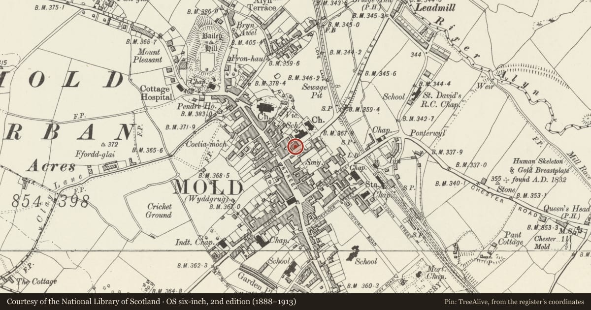
5 historical maps cover this location, the earliest the 1795 map "To Sir Watkin Williams-Wynn Bart ... the map of the six counties of North Wales is most humbly inscribed by his obedient humble servant" (Llyfrgell Genedlaethol Cymru – The National Library of Wales).
Historical maps covering this location
- 1795 · To Sir Watkin Williams-Wynn Bart ... the map of the six counties of North Wales is most… (Llyfrgell Genedlaethol Cymru – The National Library of Wales)
- 1883 · Watershed map England, Wales 3. (David Rumsey Map Collection, Stanford Libraries)
- 1898 · 108 Flint (Hills) (David Rumsey Map Collection, Stanford Libraries)
- 1898 · 108 Flint (Outline) (David Rumsey Map Collection, Stanford Libraries)
- 1901 · Sheet 9 and 10. (David Rumsey Map Collection, Stanford Libraries)
Cadw's description
Location
On street line near the end of a broken terrace opposite the cattle market.
Exterior
Early C19 Georgian, 3 storey, 4 window flemish bond brick. Gently pitched slate roof with toothed corbels at eaves. Truncated rendered brick chimney stacks. Upper floor windows to No 8 are 8 pane shallow sashes; those on 8a deeper 4 pane sliding sashes. 1st floor, 16 pane sashes, pane reveals.
Ground floor brickwork removed and replaced by 7 cast iron columns with Gothic capitals and swelling bases. Modern fenestration now inserted behind. Single gabled fascia end with tile panel remains to right on No 8a.
Nearby in the register
- 8 King StreetDomesticunder 1 mi
- Thomsons Wines & SpirtsCommercialunder 1 mi
- Church HallReligious, Ritual and Funeraryunder 1 mi
- H.I. Jones, ChemistCommercialunder 1 mi
Other entries of the same register within about three miles of this one, by straight line.