Cof Cymru: National Historic Assets of Wales · Wales
2 Church Street
Caernarfon, Gwynedd, Wales
A Grade II listed building in Walled town, Caernarfon, Gwynedd, designated on 31 March 1983.
The record
- Designation
- Listed building, Grade II
- Broad class
- Domestic
- Date of designation
- 31 March 1983
- Locality
- Walled town
- Town
- Caernarfon
- Community
- Caernarfon
- Unitary authority
- Gwynedd
- Country
- Wales
- Coordinates
- 53.14086, -4.27746
- Cadw reference
- 3853
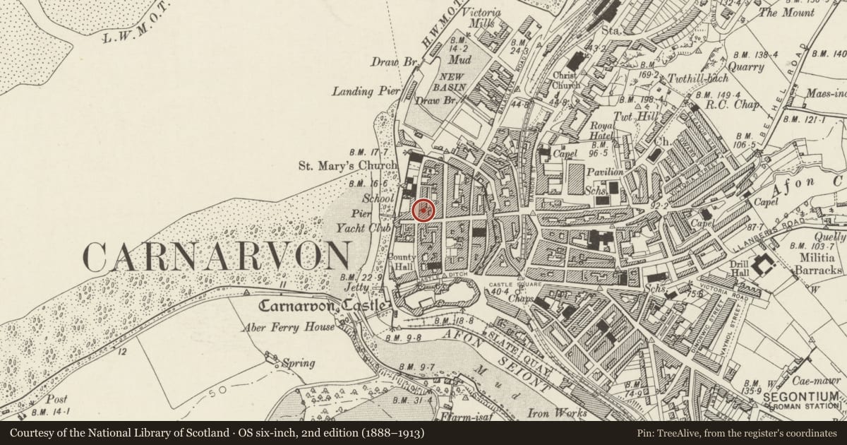
Slide toward Today to fade the historical sheet and see the modern map underneath.
David Rumsey Map Collection, Stanford LibrariesDavid Rumsey Map Collection, Stanford LibrariesDavid Rumsey Map Collection, Stanford LibrariesDavid Rumsey Map Collection, Stanford LibrariesDavid Rumsey Map Collection, Stanford Libraries
5 historical maps cover this location, the earliest the 1883 map "Watershed map England, Wales 3." (David Rumsey Map Collection, Stanford Libraries).
Historical maps covering this location
- 1883 · Watershed map England, Wales 3. (David Rumsey Map Collection, Stanford Libraries)
- 1896 · Sheet 7. Ordnance Survey of England and Wales. (David Rumsey Map Collection, Stanford Libraries)
- 1899 · 105 Carnarvon (Hills) (David Rumsey Map Collection, Stanford Libraries)
- 1901 · Sheet 9 and 10. (David Rumsey Map Collection, Stanford Libraries)
- 1919 · Sheet 41. Anglesey. (David Rumsey Map Collection, Stanford Libraries)
Cadw's description
Location
At the S end of the street, adjoining Plas Bowman (5 High Street).
History
Probably early C19 and shown on the 1810 town plan. A tablet dated 1652 with the monogram 'WT', possibly William Thomas, was perhaps re-used from an earlier house on the site. It was originally a 3-bay house, although the 1834 town plan shows it to have already been incorporated into Plas Bowman facing High Street. It was altered late C19, in conjunction with Plas Bowman, when the fenestration was altered and the front was roughcast. By this time it had become business premises and in 1895 was occupied by solicitors' offices.
Exterior
A 2-window 3-storey house of painted and scribed roughcast walls and slate roof on a plain wooden eaves cornice, with brick end stacks. A central half-lit panelled door has a round-headed overlight and a canopy projecting on iron brackets, and with diagonal strut above. The windows are 3-light with wood mullions and transoms, and are enlargements of original sash windows. The shadows of original sash windows blocked late C19 are visible within the roughcast to the centre of the middle and upper storeys.
Interior
Not inspected.
Reason for designation
Listed for its C19 character, for group value with Plas Bowman and for its contribution to the historic integrity of the walled town.
Nearby in the register
- Plas BowmanDomesticunder 1 mi
- 7 High StreetCommercialunder 1 mi
- Hendre AurDomesticunder 1 mi
- CilgwynDomesticunder 1 mi
Other entries of the same register within about three miles of this one, by straight line.