Cof Cymru: National Historic Assets of Wales · Wales
Keene & Kelly Solicitors, Allwood, Baird & Co., Leeds Permanent Building Society
Mold, Flintshire, Wales
A Grade II listed building in Mold, Flintshire, designated on 30 March 1987.
The record
- Designation
- Listed building, Grade II
- Broad class
- Commercial
- Date of designation
- 30 March 1987
- Community
- Mold
- Unitary authority
- Flintshire
- Country
- Wales
- Coordinates
- 53.16957, -3.14448
- Cadw reference
- 385
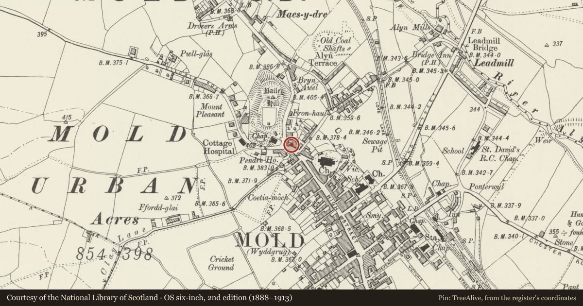
Slide toward Today to fade the historical sheet and see the modern map underneath.
David Rumsey Map Collection, Stanford LibrariesDavid Rumsey Map Collection, Stanford LibrariesDavid Rumsey Map Collection, Stanford LibrariesDavid Rumsey Map Collection, Stanford LibrariesLlyfrgell Genedlaethol Cymru – The National Library of Wales
5 historical maps cover this location, the earliest the 1795 map "To Sir Watkin Williams-Wynn Bart ... the map of the six counties of North Wales is most humbly inscribed by his obedient humble servant" (Llyfrgell Genedlaethol Cymru – The National Library of Wales).
Historical maps covering this location
- 1795 · To Sir Watkin Williams-Wynn Bart ... the map of the six counties of North Wales is most… (Llyfrgell Genedlaethol Cymru – The National Library of Wales)
- 1883 · Watershed map England, Wales 3. (David Rumsey Map Collection, Stanford Libraries)
- 1898 · 108 Flint (Hills) (David Rumsey Map Collection, Stanford Libraries)
- 1898 · 108 Flint (Outline) (David Rumsey Map Collection, Stanford Libraries)
- 1901 · Sheet 9 and 10. (David Rumsey Map Collection, Stanford Libraries)
Cadw's description
Location
Set behind a small railed garden on the street line at the corner of the High Street with Denbigh Road.
Exterior
Substantial house of C17 origins, altered during C18 and later. Original layout of half with lateral chimney and service rooms at SE end over which was principal chamber; parlour to cross wing? building used as private school in mid C19 and currently subdivided into offices.
2 storeys, truncated cross wing with attic and cellar to left. Uncoursed rubble, whitewashed scribed plaster to front. Steep pitched slate roof, largely pitch daubed. Lateral chimney with kneelers to gablet. Later brick stacks. Main range is 4 bays with 3, 12 pane sash windows to each floor. Painted sills, plain reveals. doorway with panelled C19 door and 4 light rectangular fan, offset to left in former angle. 2 narrow small paned sashes over a 3 light sash to truncated window. Number of late brick additions of no special interest to rear.
Through purlin tie beam with lower angle struts; evidence of sub-division of attics. Plastered stop chamfered beams run axially in main range, transversly in truncated wing.
Reason for designation
Group value.
Nearby in the register
- Wilding Civil Engineering Ltd. and Powell Public RelationsCommercialunder 1 mi
- 106 High StreetDomesticunder 1 mi
- Crest HouseDomesticunder 1 mi
- 108 High StreetDomesticunder 1 mi
Other entries of the same register within about three miles of this one, by straight line.