Cof Cymru: National Historic Assets of Wales · Wales
Aber Ferry House
Caernarfon, Gwynedd, Wales
A Grade II listed building in Coed Helen, Caernarfon, Gwynedd, designated on 31 March 1983.
The record
- Designation
- Listed building, Grade II
- Broad class
- Domestic
- Date of designation
- 31 March 1983
- Locality
- Coed Helen
- Town
- Caernarfon
- Community
- Caernarfon
- Unitary authority
- Gwynedd
- Country
- Wales
- Coordinates
- 53.13884, -4.27986
- Cadw reference
- 3818
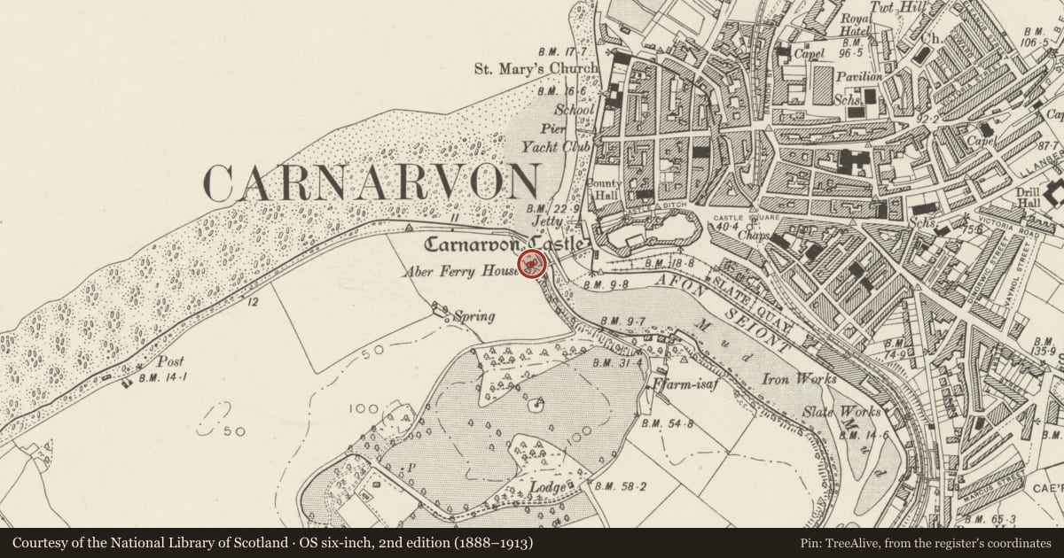
Slide toward Today to fade the historical sheet and see the modern map underneath.
David Rumsey Map Collection, Stanford LibrariesDavid Rumsey Map Collection, Stanford LibrariesDavid Rumsey Map Collection, Stanford LibrariesDavid Rumsey Map Collection, Stanford LibrariesDavid Rumsey Map Collection, Stanford Libraries
5 historical maps cover this location, the earliest the 1883 map "Watershed map England, Wales 3." (David Rumsey Map Collection, Stanford Libraries).
Historical maps covering this location
- 1883 · Watershed map England, Wales 3. (David Rumsey Map Collection, Stanford Libraries)
- 1896 · Sheet 7. Ordnance Survey of England and Wales. (David Rumsey Map Collection, Stanford Libraries)
- 1899 · 105 Carnarvon (Hills) (David Rumsey Map Collection, Stanford Libraries)
- 1901 · Sheet 9 and 10. (David Rumsey Map Collection, Stanford Libraries)
- 1919 · Sheet 41. Anglesey. (David Rumsey Map Collection, Stanford Libraries)
Cadw's description
Location
Set back from the road and prominently sited opposite Aber Bridge.
History
Built in 1822 (date on building) in conjunction with the ferry crossing the Afon Seiont between Coed Helen and Caernarfon Castle, and shown on the 1841 Tithe map.
Exterior
A castellated single-storey double-fronted ferry house of coursed dressed stone with diagonal buttresses, and a hipped slate roof behind an embattled parapet with stone stack to the L. A shallow splayed central porch has diagonal buttresses and has a replaced door and pointed overlight. Windows R and L have pointed heads with hood moulds and are replaced with casement windows. The R end wall has a single window similar to the front, with metal-framed casement. It is flanked by recessed shields bearing the date 1822 on the R, while the L bears the monogram 'RT' and is inscribed 'the greatest drown'. Stone steps descend to a basement with 2 blocked openings. The L side wall has an inserted window to the L of the stack. A single-storey rear projection is rendered.
Reason for designation
Listed as a small castellated house retaining early character and for its contribution to the setting of Caernarfon Castle.
Nearby in the register
- Quay walls at Slate QuayMaritimeunder 1 mi
- Police Station, including forecourt railings and gate piersCivilunder 1 mi
- The Anglesey Hotel Including Courtyard Wall to RearCommercialunder 1 mi
- County Court (former County Hall)Civilunder 1 mi
Other entries of the same register within about three miles of this one, by straight line.