Cof Cymru: National Historic Assets of Wales · Wales
Barn/Cowhouse at Plas Glan-yr-Afon
Waunfawr, Gwynedd, Wales
A Grade II listed building in Plas Glan-yr-Afon, Waunfawr, Gwynedd, designated on 29 May 1968.
The record
- Designation
- Listed building, Grade II
- Broad class
- Agriculture and Subsistence
- Date of designation
- 29 May 1968
- Locality
- Plas Glan-yr-Afon
- Community
- Waunfawr
- Unitary authority
- Gwynedd
- Country
- Wales
- Coordinates
- 53.11421, -4.23673
- Cadw reference
- 3811
Slide toward Today to fade the historical sheet and see the modern map underneath.
David Rumsey Map Collection, Stanford LibrariesDavid Rumsey Map Collection, Stanford LibrariesDavid Rumsey Map Collection, Stanford LibrariesDavid Rumsey Map Collection, Stanford LibrariesLlyfrgell Genedlaethol Cymru – The National Library of Wales
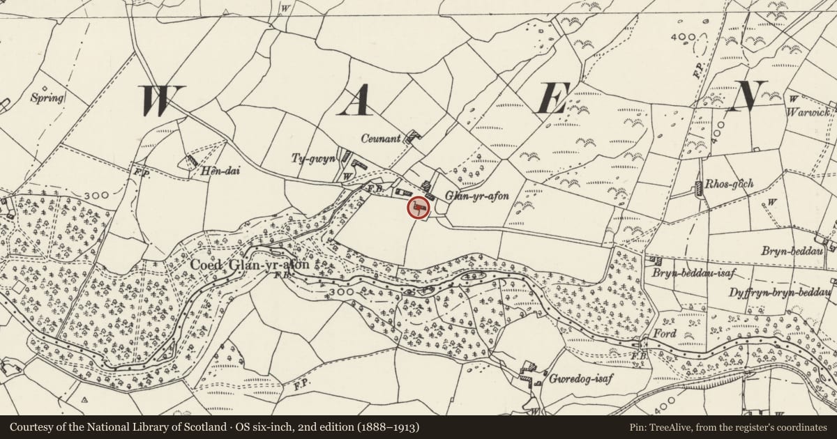
5 historical maps cover this location, the earliest the 1795 map "To Sir Watkin Williams-Wynn Bart ... the map of the six counties of North Wales is most humbly inscribed by his obedient humble servant" (Llyfrgell Genedlaethol Cymru – The National Library of Wales).
Historical maps covering this location
- 1795 · To Sir Watkin Williams-Wynn Bart ... the map of the six counties of North Wales is most… (Llyfrgell Genedlaethol Cymru – The National Library of Wales)
- 1896 · Sheet 7. Ordnance Survey of England and Wales. (David Rumsey Map Collection, Stanford Libraries)
- 1899 · 105 Carnarvon (Hills) (David Rumsey Map Collection, Stanford Libraries)
- 1901 · Sheet 9 and 10. (David Rumsey Map Collection, Stanford Libraries)
- 1919 · Sheet 41. Anglesey. (David Rumsey Map Collection, Stanford Libraries)
Cadw's description
Location
Located on the south side of the farmyard at Plas Glan-yr-Afon.
History
Late C17 barn with cowhouse on one side and lean-to to other added in mid-C19.
Exterior
3-bay barn aligned roughly north-south with lean-to attached to west long wall and lower cowhouse, flush with the north gable end, projecting to the east. Roughly coursed rubblestone, more tightly jointed to barn; slate roofs. North gable end of barn has central doorway flanked by tall rectangular window openings and a central pitching door to upper level. Cowhouse has 2 stable doors to front and small window in corner next to barn.
Interior
Barn has 2 large pegged A-frame trusses with ties apparently cut off near ends. Doorway to back wall and another in left wall leading to cowhouse, which has C19 A-frame truss roof.
Reason for designation
Included as a well-preserved late C17 small barn, with mid-C19 cowhouse attached, forming a good group with the other buidings at Plas Glan-yr-Afon.
Nearby in the register
- Stables/Bothy at Plas Glan-yr-AfonAgriculture and Subsistenceunder 1 mi
- Plas Glan-yr-AfonDomesticunder 1 mi
- Enclosed Hut Circle Settlement in Coed Glan-yr-AfonEnclosed hut circleunder 1 mi
- Tyddyn y GwyddDomesticunder 1 mi
Other entries of the same register within about three miles of this one, by straight line.