Cof Cymru: National Historic Assets of Wales · Wales
No.5 Cilgant (The Crescent)
Llandwrog, Gwynedd, Wales
A Grade II listed building in Llandwrog, Caernarfon, Gwynedd, designated on 29 May 1968.
The record
- Designation
- Listed building, Grade II
- Broad class
- Domestic
- Date of designation
- 29 May 1968
- Locality
- Llandwrog
- Town
- Caernarfon
- Community
- Llandwrog
- Unitary authority
- Gwynedd
- Country
- Wales
- Coordinates
- 53.07971, -4.31373
- Cadw reference
- 3778
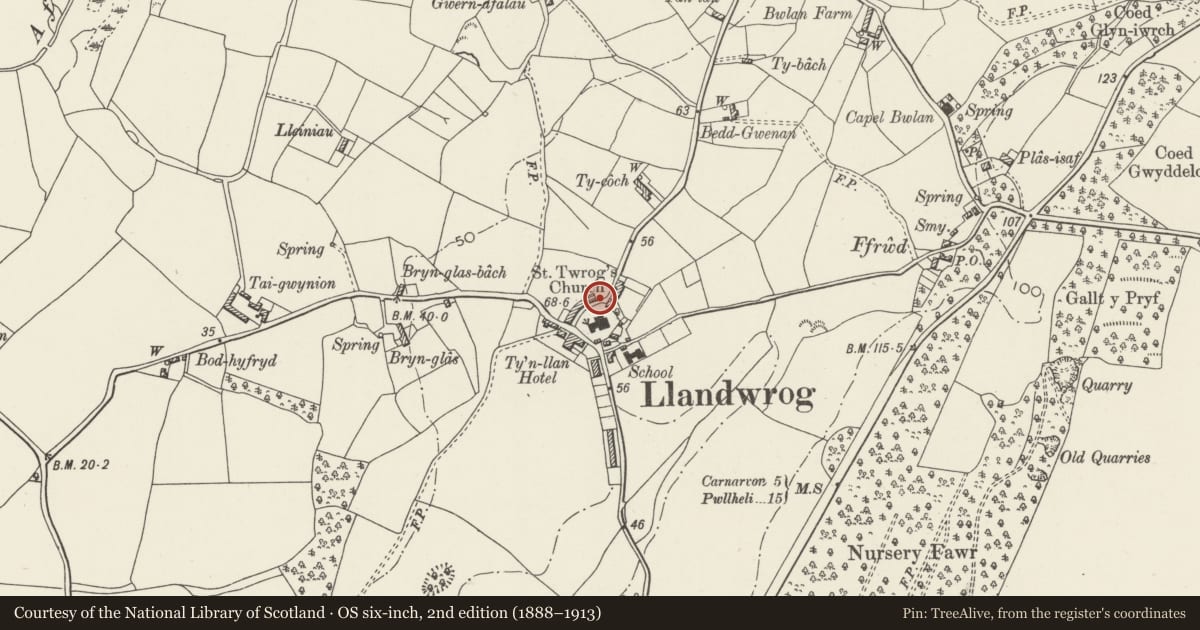
Slide toward Today to fade the historical sheet and see the modern map underneath.
David Rumsey Map Collection, Stanford LibrariesDavid Rumsey Map Collection, Stanford LibrariesDavid Rumsey Map Collection, Stanford LibrariesDavid Rumsey Map Collection, Stanford LibrariesLlyfrgell Genedlaethol Cymru – The National Library of Wales
5 historical maps cover this location, the earliest the 1795 map "To Sir Watkin Williams-Wynn Bart ... the map of the six counties of North Wales is most humbly inscribed by his obedient humble servant" (Llyfrgell Genedlaethol Cymru – The National Library of Wales).
Historical maps covering this location
- 1795 · To Sir Watkin Williams-Wynn Bart ... the map of the six counties of North Wales is most… (Llyfrgell Genedlaethol Cymru – The National Library of Wales)
- 1883 · Watershed map England, Wales 3. (David Rumsey Map Collection, Stanford Libraries)
- 1896 · Sheet 7. Ordnance Survey of England and Wales. (David Rumsey Map Collection, Stanford Libraries)
- 1899 · 118 Nevin (Hills) (David Rumsey Map Collection, Stanford Libraries)
- 1901 · Sheet 9 and 10. (David Rumsey Map Collection, Stanford Libraries)
Cadw's description
Location
Situated immediately to north of church in centre of village; full-length rubblestone wall with iron gates to small front gardens follows concave curve of road to front.
History
Built between 1850 and 1860 as part of the third Lord Newborough's replanning of Llandwrog as an estate village.
Interior
Interior not inspected at time of Survey.
Reason for designation
Included as a particularly striking piece of estate village planning, using a consistent Picturesque architectural vocabulary and unusual in its choice of the crescent shape for buildings of this modest scale. Llandwrog is among the best-preserved Victorian estate villages in this part of Wales.
Nearby in the register
- Horse Drinking TroughWater Supply and Drainageunder 1 mi
- No.4 Cilgant (The Crescent)Domesticunder 1 mi
- No.3 Cilgant (The Crescent)Domesticunder 1 mi
- CilgantDomesticunder 1 mi
Other entries of the same register within about three miles of this one, by straight line.