Cof Cymru: National Historic Assets of Wales · Wales
Ty Ucha'r Ffordd
Llanberis, Gwynedd, Wales
A Grade II listed building in Pentre-castell, Caernarfon, Llanberis, Gwynedd, designated on 29 May 1968.
The record
- Designation
- Listed building, Grade II
- Broad class
- Domestic
- Date of designation
- 29 May 1968
- Locality
- Pentre-castell
- Town
- Caernarfon
- Community
- Llanberis
- Unitary authority
- Gwynedd
- Country
- Wales
- Coordinates
- 53.11465, -4.11276
- Cadw reference
- 3767
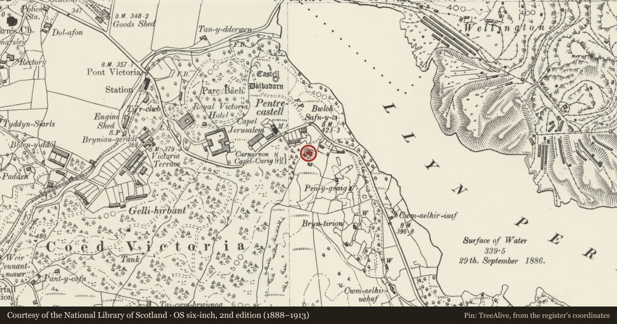
Slide toward Today to fade the historical sheet and see the modern map underneath.
David Rumsey Map Collection, Stanford LibrariesDavid Rumsey Map Collection, Stanford LibrariesDavid Rumsey Map Collection, Stanford LibrariesDavid Rumsey Map Collection, Stanford LibrariesDavid Rumsey Map Collection, Stanford Libraries
5 historical maps cover this location, the earliest the 1896 map "Sheet 7. Ordnance Survey of England and Wales." (David Rumsey Map Collection, Stanford Libraries).
Historical maps covering this location
- 1896 · Sheet 7. Ordnance Survey of England and Wales. (David Rumsey Map Collection, Stanford Libraries)
- 1899 · 106 Bangor (Hills) (David Rumsey Map Collection, Stanford Libraries)
- 1899 · 106 Bangor (Outline) (David Rumsey Map Collection, Stanford Libraries)
- 1901 · Sheet 9 and 10. (David Rumsey Map Collection, Stanford Libraries)
- 1919 · Sheet 41. Anglesey. (David Rumsey Map Collection, Stanford Libraries)
Cadw's description
Location
Located on a natural rock outcrop on the south-west side of the A 4086 overlooking Pentre-castell and Dolbadarn Castle; there is a stone retaining wall directly in front of the cottage.
History
Early C19 smallholder's/quarryworker's cottage. The cottage is shown on the 1838 Tithe Map, at which time the land on which it stood belonged to the (Royal) Victoria Hotel.
Exterior
Smallholder's/quarryworker's cottage. Single-storey 3-room plan. Painted rubblestone, formerly limewashed; slate roof. Late C20 top-hung windows to either side of prominent C20 gabled porch with glazed inner door to right; further window to left. Integral end stacks and ridge stack slightly to left of centre.
Interior
Much altered in late C20.
Reason for designation
Listed, notwithstanding its extensive C20 alterations, as an early C19 smallholder's/quarryworker's cottage built within the local vernacular tradition and strikingly located above Dolbadarn Castle.
Nearby in the register
- Glandwr CottageDomesticunder 1 mi
- Capel Jerusalem with former domestic accommodation to rearReligious, Ritual and Funeraryunder 1 mi
- Bryn EithinDomesticunder 1 mi
- Dolbadarn CastleDefenceunder 1 mi
Other entries of the same register within about three miles of this one, by straight line.