Cof Cymru: National Historic Assets of Wales · Wales
The Court House
Clynnog, Gwynedd, Wales
A Grade II listed building in Clynnog-fawr, Caernarfon, Clynnog, Gwynedd, designated on 29 May 1968.
The record
- Designation
- Listed building, Grade II
- Broad class
- Domestic
- Date of designation
- 29 May 1968
- Locality
- Clynnog-fawr
- Town
- Caernarfon
- Community
- Clynnog
- Unitary authority
- Gwynedd
- Country
- Wales
- Coordinates
- 53.02124, -4.36495
- Cadw reference
- 3761
Slide toward Today to fade the historical sheet and see the modern map underneath.
David Rumsey Map Collection, Stanford LibrariesDavid Rumsey Map Collection, Stanford LibrariesDavid Rumsey Map Collection, Stanford LibrariesDavid Rumsey Map Collection, Stanford LibrariesLlyfrgell Genedlaethol Cymru – The National Library of Wales
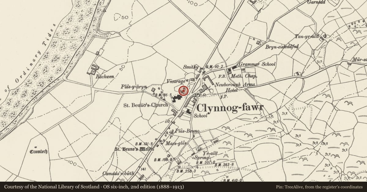
5 historical maps cover this location, the earliest the 1795 map "To Sir Watkin Williams-Wynn Bart ... the map of the six counties of North Wales is most humbly inscribed by his obedient humble servant" (Llyfrgell Genedlaethol Cymru – The National Library of Wales).
Historical maps covering this location
- 1795 · To Sir Watkin Williams-Wynn Bart ... the map of the six counties of North Wales is most… (Llyfrgell Genedlaethol Cymru – The National Library of Wales)
- 1883 · Watershed map England, Wales 3. (David Rumsey Map Collection, Stanford Libraries)
- 1896 · Sheet 7. Ordnance Survey of England and Wales. (David Rumsey Map Collection, Stanford Libraries)
- 1899 · 118 Nevin (Hills) (David Rumsey Map Collection, Stanford Libraries)
- 1901 · Sheet 9 and 10. (David Rumsey Map Collection, Stanford Libraries)
Cadw's description
Location
The house is immediately outside NE side of the churchyard, facing towards the church.
History
The house is of the late C17 or c1700, uphill sited, and was probably originally the vicarage.
Exterior
A small dwelling built of rubble with an irregular slate roof between tall gable stacks. One storey and attic, 3 window bays, the almost symmetrical front facing the church being offset to the left. Boarded door with a glazed panel, set centrally between tall moulded timber cross windows on the ground floor; similar 2-light windows within raised and gabled dormers to the first floor, all windows of recent date and with diamond leading. Weather drip course on the major uphill stack.
Interior
Not seen at the time of inspection. Said by RCAHMW to have early chamfered beams and joists, and a large fireplace.
Reason for designation
Included as a building retaining the shape and form of a C17 vernacular house, set in close proximity to the parish church and associated monuments, all in a village-centre setting.
Nearby in the register
- Tomb of Eben FarddReligious, Ritual and Funeraryunder 1 mi
- Church of St Beuno, with attached Chapel of St BeunoReligious, Ritual and Funeraryunder 1 mi
- Lychgate to the churchyard of the Church of St BeunoReligious, Ritual and Funeraryunder 1 mi
- Bod CybiDomesticunder 1 mi
Other entries of the same register within about three miles of this one, by straight line.