Cof Cymru: National Historic Assets of Wales · Wales
BBC Radio Clwyd
Mold, Flintshire, Wales
A Grade II listed building in Mold, Flintshire, designated on 30 March 1987.
The record
- Designation
- Listed building, Grade II
- Broad class
- Domestic
- Date of designation
- 30 March 1987
- Locality
- Mold
- Community
- Mold
- Unitary authority
- Flintshire
- Country
- Wales
- Coordinates
- 53.16467, -3.14181
- Cadw reference
- 368
Slide toward Today to fade the historical sheet and see the modern map underneath.
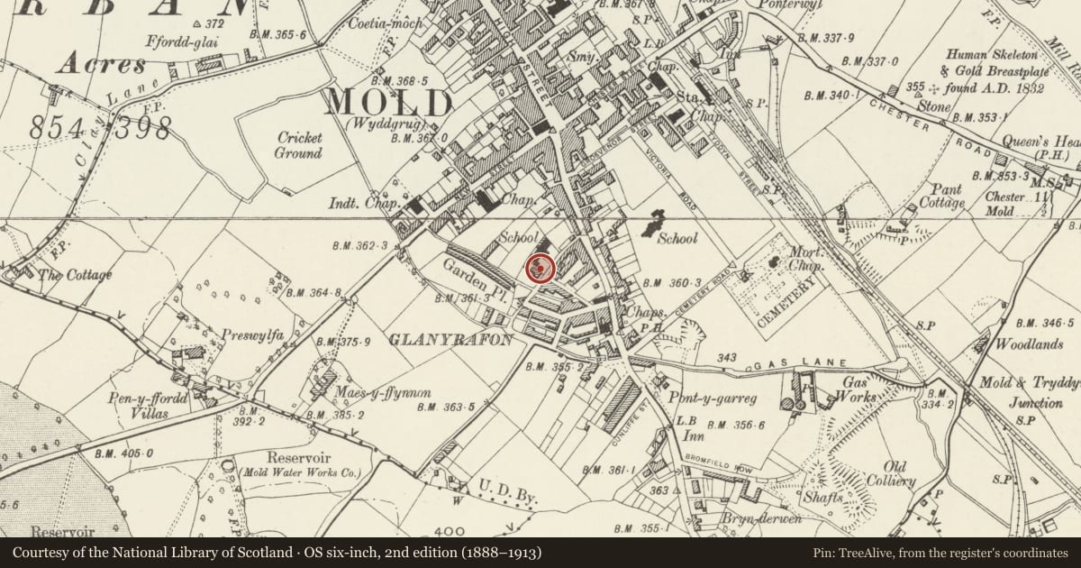
David Rumsey Map Collection, Stanford LibrariesDavid Rumsey Map Collection, Stanford LibrariesDavid Rumsey Map Collection, Stanford LibrariesDavid Rumsey Map Collection, Stanford LibrariesLlyfrgell Genedlaethol Cymru – The National Library of Wales
5 historical maps cover this location, the earliest the 1795 map "To Sir Watkin Williams-Wynn Bart ... the map of the six counties of North Wales is most humbly inscribed by his obedient humble servant" (Llyfrgell Genedlaethol Cymru – The National Library of Wales).
Historical maps covering this location
- 1795 · To Sir Watkin Williams-Wynn Bart ... the map of the six counties of North Wales is most… (Llyfrgell Genedlaethol Cymru – The National Library of Wales)
- 1883 · Watershed map England, Wales 3. (David Rumsey Map Collection, Stanford Libraries)
- 1898 · 108 Flint (Hills) (David Rumsey Map Collection, Stanford Libraries)
- 1898 · 108 Flint (Outline) (David Rumsey Map Collection, Stanford Libraries)
- 1901 · Sheet 9 and 10. (David Rumsey Map Collection, Stanford Libraries)
Cadw's description
Location
In its own grounds facing the junction of Chapel Street with Glanrafon Road.
History
1875-6 by John Douglas of Chester in Arts and Crafts style. Formerly the schoolmaster's house for the adjacent British School.
Exterior
L-shaped, 2 storey english bond brick with half-timbered gable advanced to street. Medium pitch slate roof, deep verges and eaves, exposed purlins. Eaves brackets to advanced gable. Projecting stepped chimney to right end, truncated similar to rear.
Buttresses sweep out at W and S corners, saw edged string courses to principal elevations. 6 light small paned window to half timbered gable. (Serves two rooms). Stone mullioned windows to ground floor. Asymmetric 2 and 4 light to advanced gable, 4 light to other wing. Modern glazing. Cambered brick arches to rear openings.
Catslide hood on brackets to square headed doorway to left of advanced bay. Contemporary railed forecourt.
Nearby in the register
- Britannia Inn P.H.Commercialunder 1 mi
- 55 Wrexham StreetDomesticunder 1 mi
- 53 Wrexham StreetDomesticunder 1 mi
- 51 Wrexhan StreetDomesticunder 1 mi
Other entries of the same register within about three miles of this one, by straight line.