Cof Cymru: National Historic Assets of Wales · Wales
Pen-y-Bont Inn
Llanrwst, Conwy, Wales
A Grade II listed building in Llanrwst, Conwy, designated on 19 February 1993.
The record
- Designation
- Listed building, Grade II
- Broad class
- Commercial
- Date of designation
- 19 February 1993
- Locality
- Llanrwst
- Community
- Llanrwst
- Unitary authority
- Conwy
- Country
- Wales
- Coordinates
- 53.13747, -3.79753
- Cadw reference
- 3616
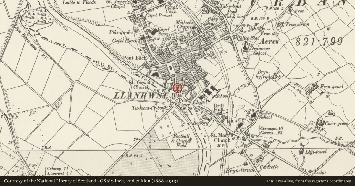
Slide toward Today to fade the historical sheet and see the modern map underneath.
David Rumsey Map Collection, Stanford LibrariesDavid Rumsey Map Collection, Stanford LibrariesDavid Rumsey Map Collection, Stanford LibrariesLlyfrgell Genedlaethol Cymru – The National Library of WalesDavid Rumsey Map Collection, Stanford Libraries
5 historical maps cover this location, the earliest the 1795 map "To Sir Watkin Williams-Wynn Bart ... the map of the six counties of North Wales is most humbly inscribed by his obedient humble servant" (Llyfrgell Genedlaethol Cymru – The National Library of Wales).
Historical maps covering this location
- 1795 · To Sir Watkin Williams-Wynn Bart ... the map of the six counties of North Wales is most… (Llyfrgell Genedlaethol Cymru – The National Library of Wales)
- 1883 · Watershed map England, Wales 3. (David Rumsey Map Collection, Stanford Libraries)
- 1899 · 106 Bangor (Outline) (David Rumsey Map Collection, Stanford Libraries)
- 1899 · 106 Bangor (Hills) (David Rumsey Map Collection, Stanford Libraries)
- 1901 · Sheet 9 and 10. (David Rumsey Map Collection, Stanford Libraries)
Cadw's description
Location
On prominent corner site near Pont Fawr, to W of Victoria Hotel.
History
Probably C18 with alterations of later C19.
Exterior
Two storeys, five windows. Roughcast with raised horizontal, vertical, and plinth bands in smooth render; slate roof with brick chimneys. Vertical bands divide main front into two. Right section has entrance doorway, double doors with overlight; canopy on cast-iron brackets. Door flanked by horned sash windows with three panes per sash. Three similar windows above. Left section has two first floor windows (6 pane horned sashes), and on ground floor, two windows that to L formerly door with small canopy on cast-iron brackets. Right (S) gabled elevation with single first floor window as main windows on front.
Reason for designation
Group value.
Nearby in the register
- Wall to the North of Pont FawrDomesticunder 1 mi
- Pont FawrTransportunder 1 mi
- Cornucopia HotelCommercialunder 1 mi
- Llanrwst BridgeBridgeunder 1 mi
Other entries of the same register within about three miles of this one, by straight line.