Cof Cymru: National Historic Assets of Wales · Wales
North Llanrwst Station (Building on East Platform)
Llanrwst, Conwy, Wales
A Grade II listed building in Llanrwst, Conwy, designated on 19 February 1993.
The record
- Designation
- Listed building, Grade II
- Broad class
- Transport
- Date of designation
- 19 February 1993
- Community
- Llanrwst
- Unitary authority
- Conwy
- Country
- Wales
- Coordinates
- 53.14399, -3.80254
- Cadw reference
- 3608
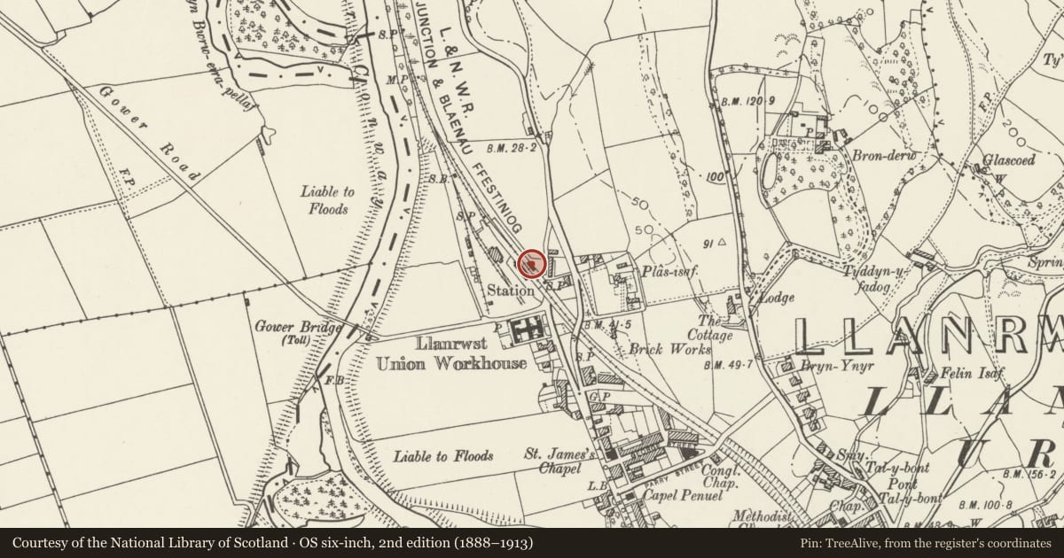
Slide toward Today to fade the historical sheet and see the modern map underneath.
David Rumsey Map Collection, Stanford LibrariesDavid Rumsey Map Collection, Stanford LibrariesDavid Rumsey Map Collection, Stanford LibrariesLlyfrgell Genedlaethol Cymru – The National Library of WalesDavid Rumsey Map Collection, Stanford Libraries
5 historical maps cover this location, the earliest the 1795 map "To Sir Watkin Williams-Wynn Bart ... the map of the six counties of North Wales is most humbly inscribed by his obedient humble servant" (Llyfrgell Genedlaethol Cymru – The National Library of Wales).
Historical maps covering this location
- 1795 · To Sir Watkin Williams-Wynn Bart ... the map of the six counties of North Wales is most… (Llyfrgell Genedlaethol Cymru – The National Library of Wales)
- 1883 · Watershed map England, Wales 3. (David Rumsey Map Collection, Stanford Libraries)
- 1899 · 106 Bangor (Outline) (David Rumsey Map Collection, Stanford Libraries)
- 1899 · 106 Bangor (Hills) (David Rumsey Map Collection, Stanford Libraries)
- 1901 · Sheet 9 and 10. (David Rumsey Map Collection, Stanford Libraries)
Cadw's description
Location
Station approximately 800m NNW of town centre on road branching off A 470.
History
Probably building of circa 1878, when line was improved and extended.
Exterior
On E platform of station; single-storey low, pitched roof with wide eaves (esp to W overhanging as canopy on arch-braced wooden brackets); sheet roof covering. Random dark stone rubble; bathstone dressings; plinth. Central recessed waiting area with broad opening under wooden lintel with central chamfered post and arch braces; wooden bench to rear, boarded ceiling above moulded joists, herringbone brick floor, interior sides partitioned off. Outer bays each have three-light mullioned stone windows; North and south elevations have window as front.
Reason for designation
Included for group value with main station building.
Nearby in the register
- North Llanrwst Station (Main Building)Transportunder 1 mi
- Old PrioryDomesticunder 1 mi
- Bron DerwDomesticunder 1 mi
- Capel SeionReligious, Ritual and Funeraryunder 1 mi
Other entries of the same register within about three miles of this one, by straight line.