Cof Cymru: National Historic Assets of Wales · Wales
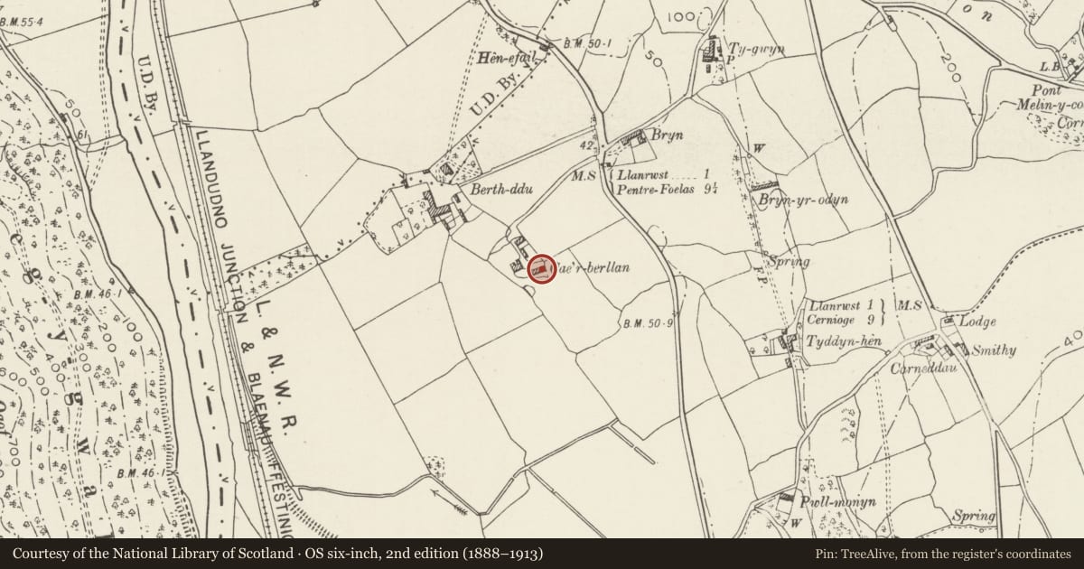
Barn & Cowhouse ar Cae'e Berllan
Llanrwst, Conwy, Wales
A Grade II listed building in Llanrwst, Conwy, designated on 19 February 1993.
The record
- Designation
- Listed building, Grade II
- Broad class
- Agriculture and Subsistence
- Date of designation
- 19 February 1993
- Locality
- Llanrwst
- Community
- Llanrwst
- Unitary authority
- Conwy
- Country
- Wales
- Coordinates
- 53.12560, -3.78578
- Cadw reference
- 3584
Slide toward Today to fade the historical sheet and see the modern map underneath.
David Rumsey Map Collection, Stanford LibrariesLlyfrgell Genedlaethol Cymru – The National Library of WalesDavid Rumsey Map Collection, Stanford LibrariesDavid Rumsey Map Collection, Stanford LibrariesDavid Rumsey Map Collection, Stanford Libraries
5 historical maps cover this location, the earliest the 1608 map "(13) Cambriae Typus." (David Rumsey Map Collection, Stanford Libraries).
Historical maps covering this location
- 1608 · (13) Cambriae Typus. (David Rumsey Map Collection, Stanford Libraries)
- 1795 · To Sir Watkin Williams-Wynn Bart ... the map of the six counties of North Wales is most… (Llyfrgell Genedlaethol Cymru – The National Library of Wales)
- 1830 · V.3:11-15:XV. Britisches Reich. A. Kon: England. b. Frstenthum Wales: Shire: 37-40 (David Rumsey Map Collection, Stanford Libraries)
- 1883 · Watershed map England, Wales 3. (David Rumsey Map Collection, Stanford Libraries)
- 1901 · Sheet 9 and 10. (David Rumsey Map Collection, Stanford Libraries)
Cadw's description
Location
Approximately 30m to E of house.
History
Probably C18 barn with added animal accommodation to E; approximately 17m x 5m.
Exterior
Local rubble with massive stones in foundations (especially to rear); old thick slate roof to main section, later slates to animal house (repairs in modern materials to one bay at rear). N elevation has steeper roof pitch to R bay. To L, doorway and window to cowhouse both with wooden lintels (blocked window over door). Square window at eaves. Two slit ventilators. To R of these, broad doorway (modern doors) with, to R, boarded door and small vent loop over. Rear has single door, and window to E.
Interior
Roof with two tiers of purlins. To W, raised cruck truss with collar (tie beam lost), purlins in W bay heavier than rest of barn and roof pitch steeper; timbers on rear of cruck to adjust pitch. Two other pegged roof trusses of collar and tie-beam type. Between barn and cowhouse, stone partition wall up to circa 2m, above this, roof truss with queen posts.
Reason for designation
Group value with Cae'r Berllan farmhouse.
Nearby in the register
- Cae'r BerllanDomesticunder 1 mi
- Cae-Melwr FarmhouseDomesticunder 1 mi
- Agricultural Range at Cae Melwr FarmAgriculture and Subsistenceunder 1 mi
- Pont Cae-MelwrTransportunder 1 mi
Other entries of the same register within about three miles of this one, by straight line.