Cof Cymru: National Historic Assets of Wales · Wales
Church Men's Club (Church Institute)
Llanfairfechan, Conwy, Wales
A Grade II listed building in Llanfairfechan, Conwy, designated on 14 April 1992.
The record
- Designation
- Listed building, Grade II
- Broad class
- Religious, Ritual and Funerary
- Date of designation
- 14 April 1992
- Community
- Llanfairfechan
- Unitary authority
- Conwy
- Country
- Wales
- Coordinates
- 53.25400, -3.97545
- Cadw reference
- 3566
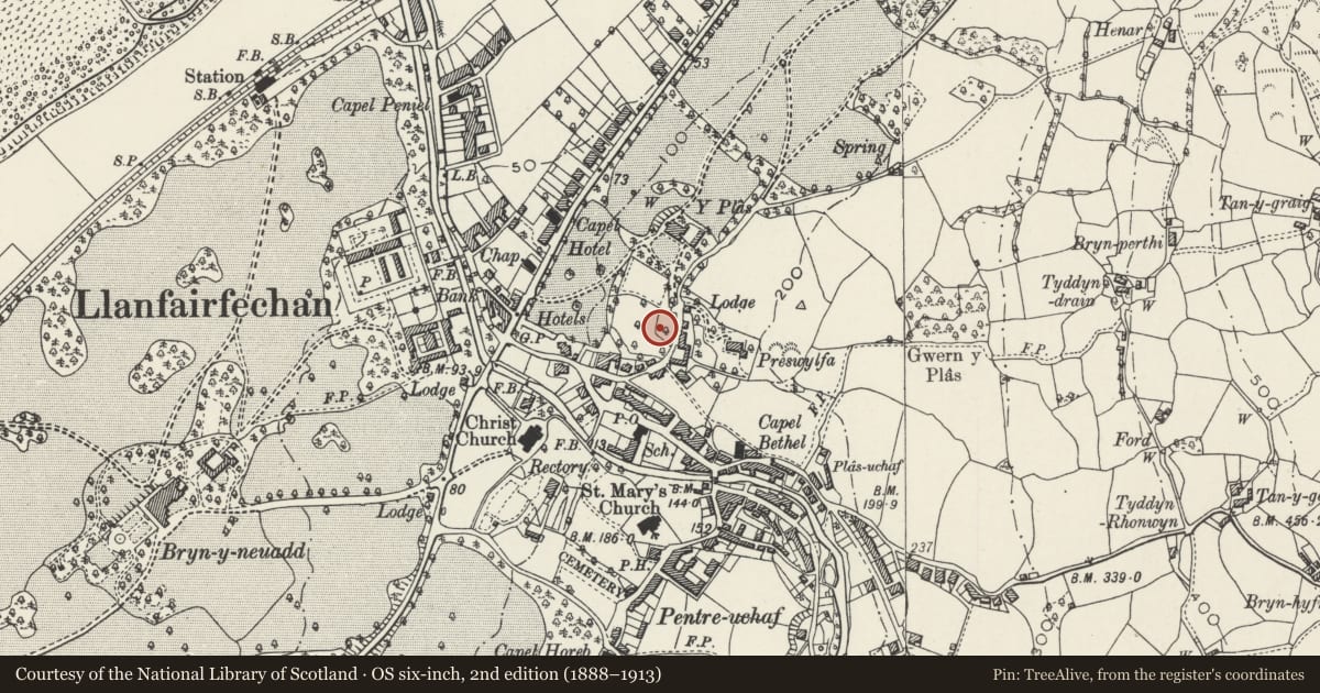
Slide toward Today to fade the historical sheet and see the modern map underneath.
David Rumsey Map Collection, Stanford LibrariesDavid Rumsey Map Collection, Stanford LibrariesDavid Rumsey Map Collection, Stanford LibrariesDavid Rumsey Map Collection, Stanford LibrariesLlyfrgell Genedlaethol Cymru – The National Library of Wales
5 historical maps cover this location, the earliest the 1795 map "To Sir Watkin Williams-Wynn Bart ... the map of the six counties of North Wales is most humbly inscribed by his obedient humble servant" (Llyfrgell Genedlaethol Cymru – The National Library of Wales).
Historical maps covering this location
- 1795 · To Sir Watkin Williams-Wynn Bart ... the map of the six counties of North Wales is most… (Llyfrgell Genedlaethol Cymru – The National Library of Wales)
- 1883 · Watershed map England, Wales 3. (David Rumsey Map Collection, Stanford Libraries)
- 1896 · Sheet 7. Ordnance Survey of England and Wales. (David Rumsey Map Collection, Stanford Libraries)
- 1899 · 106 Bangor (Outline) (David Rumsey Map Collection, Stanford Libraries)
- 1901 · Sheet 9 and 10. (David Rumsey Map Collection, Stanford Libraries)
Cadw's description
Location
Set back from road to N of Church Institute
History
1927. Architect Herbert Luck North (1871-1941), who donated site. Miniature and simplified version of adjacent Church Institute.
Exterior
Elevations in rough-cast render (now painted white). Roof laid in graded courses of small grey and russet slates from Gallt y Llan quarry, Snowdon. Blue/grey brick chimney towards L end of ridge.
Main elevation has to R, cross gable with double-pitch roof and tall mullioned and transomed window with small lead-lights lighting hall. To L, below deeply swept roof, pair of broad multi-light casement windows. At L end, entrance doorway in projecting porch with flared hipped roof. At R (north) end, gabled and slated buttress.
Reason for designation
Group with listed buildings in Park Road and The Close.
Nearby in the register
- Church InstituteReligious, Ritual and Funeraryunder 1 mi
- Plas Farmhouse (Henblas Farm)Domesticunder 1 mi
- Granary/CartshedAgriculture and Subsistenceunder 1 mi
- Slate Fence to N of Lodge to PreswylfaDomesticunder 1 mi
Other entries of the same register within about three miles of this one, by straight line.