Cof Cymru: National Historic Assets of Wales · Wales
Preswylfa
Llanfairfechan, Conwy, Wales
A Grade II listed building in Llanfairfechan, Conwy, designated on 14 April 1992.
The record
- Designation
- Listed building, Grade II
- Broad class
- Domestic
- Date of designation
- 14 April 1992
- Community
- Llanfairfechan
- Unitary authority
- Conwy
- Country
- Wales
- Coordinates
- 53.25377, -3.97400
- Cadw reference
- 3561
Slide toward Today to fade the historical sheet and see the modern map underneath.
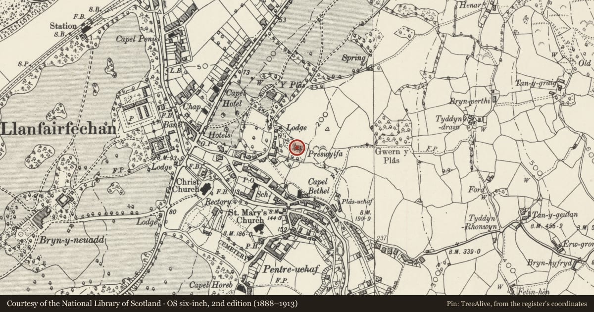
David Rumsey Map Collection, Stanford LibrariesDavid Rumsey Map Collection, Stanford LibrariesDavid Rumsey Map Collection, Stanford LibrariesDavid Rumsey Map Collection, Stanford LibrariesLlyfrgell Genedlaethol Cymru – The National Library of Wales
5 historical maps cover this location, the earliest the 1795 map "To Sir Watkin Williams-Wynn Bart ... the map of the six counties of North Wales is most humbly inscribed by his obedient humble servant" (Llyfrgell Genedlaethol Cymru – The National Library of Wales).
Historical maps covering this location
- 1795 · To Sir Watkin Williams-Wynn Bart ... the map of the six counties of North Wales is most… (Llyfrgell Genedlaethol Cymru – The National Library of Wales)
- 1883 · Watershed map England, Wales 3. (David Rumsey Map Collection, Stanford Libraries)
- 1896 · Sheet 7. Ordnance Survey of England and Wales. (David Rumsey Map Collection, Stanford Libraries)
- 1899 · 106 Bangor (Outline) (David Rumsey Map Collection, Stanford Libraries)
- 1901 · Sheet 9 and 10. (David Rumsey Map Collection, Stanford Libraries)
Cadw's description
Location
In large wooded garden on sloping ground above Park Road, to E of PLas Farm, between Park Road and The Close.
History
Later C19 house, 2 storeys plus attics.
Exterior
Grey-brown snecked rubble with freestone dressings (painted). Slate roof.
Entrance front faces N, 3 gables each with Gothic-arched window. First floor has square-headed windows, three to central bay and one to each end bay. On ground floor, small porch and, to L rectangular bay window; to R, single square-headed window.
West elevation has 2 gables each with Gothic arched window; on first floor, pointed and square-headed windows, on ground floor, to R, semi-hexagonal bay.
South elevation has 3 gables each with Gothic-arched window, lower floors treated in similar but simpler style to N and W sides.
East elevation somewhat altered with fire escape etc.
Reason for designation
Listed for group value with surrounding buildings in The Close, and Park Road.
Nearby in the register
- Ael y GwyntDomesticunder 1 mi
- WoodcotDomesticunder 1 mi
- Ty Hwnt Yr AfonDomesticunder 1 mi
- Plas Farmhouse (Henblas Farm)Domesticunder 1 mi
Other entries of the same register within about three miles of this one, by straight line.