Cof Cymru: National Historic Assets of Wales · Wales
Plas Farm Outbuildings (Henblas Farm Outbuildings)
Llanfairfechan, Conwy, Wales
A Grade II listed building in Llanfairfechan, Conwy, designated on 14 April 1992.
The record
- Designation
- Listed building, Grade II
- Broad class
- Agriculture and Subsistence
- Date of designation
- 14 April 1992
- Locality
- Llanfairfechan
- Community
- Llanfairfechan
- Unitary authority
- Conwy
- Country
- Wales
- Coordinates
- 53.25358, -3.97497
- Cadw reference
- 3560
Slide toward Today to fade the historical sheet and see the modern map underneath.
David Rumsey Map Collection, Stanford LibrariesDavid Rumsey Map Collection, Stanford LibrariesDavid Rumsey Map Collection, Stanford LibrariesDavid Rumsey Map Collection, Stanford LibrariesLlyfrgell Genedlaethol Cymru – The National Library of Wales
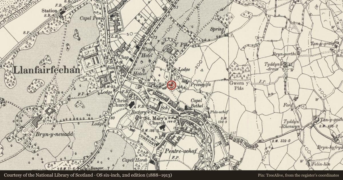
5 historical maps cover this location, the earliest the 1795 map "To Sir Watkin Williams-Wynn Bart ... the map of the six counties of North Wales is most humbly inscribed by his obedient humble servant" (Llyfrgell Genedlaethol Cymru – The National Library of Wales).
Historical maps covering this location
- 1795 · To Sir Watkin Williams-Wynn Bart ... the map of the six counties of North Wales is most… (Llyfrgell Genedlaethol Cymru – The National Library of Wales)
- 1883 · Watershed map England, Wales 3. (David Rumsey Map Collection, Stanford Libraries)
- 1896 · Sheet 7. Ordnance Survey of England and Wales. (David Rumsey Map Collection, Stanford Libraries)
- 1899 · 106 Bangor (Outline) (David Rumsey Map Collection, Stanford Libraries)
- 1901 · Sheet 9 and 10. (David Rumsey Map Collection, Stanford Libraries)
Cadw's description
Location
To R of Plas Farmhouse behind wall of grey local rubble.
History
Mid C19 range of farm buildings.
Exterior
L-shaped lay-out. Low range runs roughly N-S, whitewashed rubble, slate roof in graduated courses of grey and purple slates.
At right angles, barn; slate roof, whitewashed rubble walls with ventilation slits flanking asymmetrically-placed doorway. Standard C19 roof trusses with king posts and diagonal struts. Lower block to R with hipped roof, broad doorway flanked by wooden windows with T-bar glazing.
To S of barn range, at right angles to The Close, is Dutch barn. Stone end wall towards The Close has ventilation slots and segmental gable.
Corrugated roof covering to segmental roof. Cast-iron columns to sides set on massive flat stones. Corrugated cladding to rear (SE) side.
Reason for designation
Listed for group value with Plas Farm and surrounding listed buildings in Park Road and The Close.
Nearby in the register
- BolnhurstDomesticunder 1 mi
- Plas Farmhouse (Henblas Farm)Domesticunder 1 mi
- WoodcotDomesticunder 1 mi
- Church InstituteReligious, Ritual and Funeraryunder 1 mi
Other entries of the same register within about three miles of this one, by straight line.