Cof Cymru: National Historic Assets of Wales · Wales
Former Stable Block at Bryn-y-Neuadd Hospital (includes Yard Cottage & Bryn-y-Neuadd Cottage)
Llanfairfechan, Conwy, Wales
A Grade II listed building in Llanfairfechan, Conwy, designated on 14 April 1992.
The record
- Designation
- Listed building, Grade II
- Broad class
- Health and Welfare
- Date of designation
- 14 April 1992
- Locality
- Llanfairfechan
- Community
- Llanfairfechan
- Unitary authority
- Conwy
- Country
- Wales
- Coordinates
- 53.25241, -3.98400
- Cadw reference
- 3516
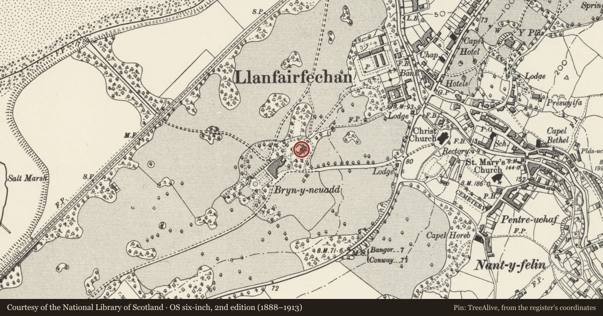
Slide toward Today to fade the historical sheet and see the modern map underneath.
David Rumsey Map Collection, Stanford LibrariesDavid Rumsey Map Collection, Stanford LibrariesDavid Rumsey Map Collection, Stanford LibrariesDavid Rumsey Map Collection, Stanford LibrariesDavid Rumsey Map Collection, Stanford Libraries
5 historical maps cover this location, the earliest the 1883 map "Watershed map England, Wales 3." (David Rumsey Map Collection, Stanford Libraries).
Historical maps covering this location
- 1883 · Watershed map England, Wales 3. (David Rumsey Map Collection, Stanford Libraries)
- 1896 · Sheet 7. Ordnance Survey of England and Wales. (David Rumsey Map Collection, Stanford Libraries)
- 1899 · 106 Bangor (Outline) (David Rumsey Map Collection, Stanford Libraries)
- 1899 · 106 Bangor (Hills) (David Rumsey Map Collection, Stanford Libraries)
- 1901 · Sheet 9 and 10. (David Rumsey Map Collection, Stanford Libraries)
Cadw's description
Location
At end of main entrance drive to Bryn-y-Neuadd Hospital.
History
Former stable and service block to Bryn-y-Neuadd Hall, built by John Platt from 1858 onwards; alterations to hospital use after Hall became hospital in 1890's.
Exterior
Arranged round courtyard. Arched entrance range faces SW (site of former house). Snecked local stone with pale freestone dressings, slate roof. Stone chimneys at ridge, to L octagonal, to R, rectangular. Gabled archway (chimney at apex of gable) with 4-centred entrance arch flanked by low buttresses; blank escutcheon in gable. To R, wall runs up into 2 dormers, L dormer corbelled forward. Ground floor has square-headed windows flanking arch. Left return gabled with single first floor window, pale limestone dressings (1850's), and two square-headed ground floor windows with golden limestone dressings (1890's). Rear (courtyard) elevation has pointed arched window over entrance arch flanked by lower 4-centred arches, that to L blocked, that to R with wooden doors.
South corner block with pyramidal roof. Doorway to L (elliptical arch with hoodmould over), and asymmetrical fenestration on two floors. Return to SE has groups of round-headed windows and at W corner, stair tower with pinnacled pyramidal roof. South-east range, two-storey, crenellated, faced in random rubble laid to courses, golden limestone dressings. Striking array of eight stone rectangular chimneys. Six bays, second and fifth bays semi-hexagonal in plan with stepped gables with arrow loops. Remaining bays have paired sash windows (entrance door in fourth bay). Attached parallel range at rear, slightly lower, with paired square-headed windows facing onto courtyard. West corner block has SE-facing gable with unusual 2-light window; lower lights have trefoils, when inverted trefoils above which are shouldered arches. To L of gable, crenellated tower (staircase tower projects above R corner) Narrow Berkeley arch type entrance door flanked by buttresses. Corner buttress at E angle. Return to NE has gable with 2-light shouldered-arch window above ground floor window with group of three lancets. One Gothic arched, and one shoulder-arched door. Single-storey gabled former power-house to R. Wall with gatepiers (stepped pyramidal caps with ball finials) links SE and NW ranges. North-west range of 2 linked blocks. Entrances face courtyard. L block has almost central dormer with window; Gothic-arched door below flanked by square-headed windows (further door to L). Wall with doorway links to similar but asymmetrical block with dormer, square first floor opening with label, door with 4-centred arch and hoodmould over, square headed window. Gable end (NE) has datestone '1858', and initial 'P', for John Platt; semi-hexagonal bay window below. Rear elevations have smaller windows of 1850's (pale limestone dressings), and somewhat larger openings of 1890's (golden limestone dressings).
Nearby in the register
- Garden Fountain in grounds at Bryn-y-Neuadd HospitalHealth and Welfareunder 1 mi
- Bryn-y-Neuadd Farmhouse, including attached dairyDomesticunder 1 mi
- Courtyard Ranges of Agricultural Buildings at Bryn-y-Neuadd FarmAgriculture and Subsistenceunder 1 mi
- Dutch Barn at Bryn-y-Neuadd FarmAgriculture and Subsistenceunder 1 mi
Other entries of the same register within about three miles of this one, by straight line.