Cof Cymru: National Historic Assets of Wales · Wales
National Westminster Bank
Llandudno, Conwy, Wales
A Grade II listed building in Llandudno, Conwy, designated on 16 March 1976.
The record
- Designation
- Listed building, Grade II
- Broad class
- Commercial
- Date of designation
- 16 March 1976
- Locality
- Llandudno
- Community
- Llandudno
- Unitary authority
- Conwy
- Country
- Wales
- Coordinates
- 53.32423, -3.83039
- Cadw reference
- 3430
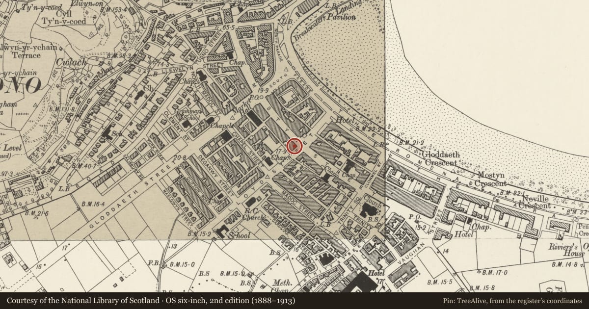
Slide toward Today to fade the historical sheet and see the modern map underneath.
David Rumsey Map Collection, Stanford LibrariesDavid Rumsey Map Collection, Stanford LibrariesDavid Rumsey Map Collection, Stanford LibrariesNational Library of ScotlandNational Library of Scotland
5 historical maps cover this location, the earliest the 1883 map "Watershed map England, Wales 3." (David Rumsey Map Collection, Stanford Libraries).
Historical maps covering this location
- 1883 · Watershed map England, Wales 3. (David Rumsey Map Collection, Stanford Libraries)
- 1885 · OS One-Inch (Hills) 1885-1903 (National Library of Scotland)
- 1899 · 94 Beaumaris (Hills) (David Rumsey Map Collection, Stanford Libraries)
- 1901 · Sheet 9 and 10. (David Rumsey Map Collection, Stanford Libraries)
- 1930 · OS Popular Edition 1919-1947 (National Library of Scotland)
Cadw's description
Location
On corner with Lloyd Street.
History
Built in late 1920, as a branch of the National Provincial Bank, to the design of FCR Palmer (see Mostyn Estate Office drawing on microfilm).
Exterior
Bank. Three storeys and attic; Lloyd Street elevation of six windows and Mostyn Street elevation of two. Hipped slate roof with box dormers. Walls faced with Portland Stone ashlar. Small-pane sash glazing to upper floors. Crowning modillion cornice and blocking course; quoins. Lloyd Street elevation has the windows set closely together and with a large blank space at each end. Second floor windows with moulded architraves and with plain aprons, the aprons descending to the top of first floor cornices. Taller first floor windows with moulded architraves and with cornices on consoles; turned balusters at sill level. Cornice at first floor level. Ground floor rusticated below impost level of windows; windows set within three tall, wide and round-headed arches with moulded archivolts and keystones. Mostyn Street elevation with two tall box dormers. Triangular pediment with modillions above second floor. First floor windows with moulded architraves, pulvinated friezes and cornices on consoles. Ground floor with recessed semi-circular headed porch in tall projecting wing with balustraded parapet and four tall urns; porch flanked to sides and returns by flat-headed niches.
Interior
Simple classical detailing to walls and ceiling of ground floor banking hall.
Reason for designation
Fine early C20 bank on prominent corner site. Group value with adjacent listed buildings on Mostyn Street, and Town Hall to rear in Lloyd Street.
Nearby in the register
- Plumes PHCommercialunder 1 mi
- 66 Mostyn StreetCommercialunder 1 mi
- 68 Mostyn StreetCommercialunder 1 mi
- Dixon'sCommercialunder 1 mi
Other entries of the same register within about three miles of this one, by straight line.