Cof Cymru: National Historic Assets of Wales · Wales
Mostyn House
Llandudno, Conwy, Wales
A Grade II listed building in Llandudno, Conwy, designated on 16 March 1976.
The record
- Designation
- Listed building, Grade II
- Broad class
- Domestic
- Date of designation
- 16 March 1976
- Locality
- Llandudno
- Community
- Llandudno
- Unitary authority
- Conwy
- Country
- Wales
- Coordinates
- 53.32756, -3.83259
- Cadw reference
- 3401
Slide toward Today to fade the historical sheet and see the modern map underneath.
David Rumsey Map Collection, Stanford LibrariesDavid Rumsey Map Collection, Stanford LibrariesDavid Rumsey Map Collection, Stanford LibrariesNational Library of ScotlandNational Library of Scotland
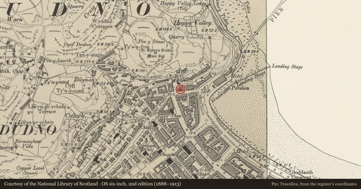
5 historical maps cover this location, the earliest the 1883 map "Watershed map England, Wales 3." (David Rumsey Map Collection, Stanford Libraries).
Historical maps covering this location
- 1883 · Watershed map England, Wales 3. (David Rumsey Map Collection, Stanford Libraries)
- 1885 · OS One-Inch (Hills) 1885-1903 (National Library of Scotland)
- 1899 · 94 Beaumaris (Hills) (David Rumsey Map Collection, Stanford Libraries)
- 1901 · Sheet 9 and 10. (David Rumsey Map Collection, Stanford Libraries)
- 1930 · OS Popular Edition 1919-1947 (National Library of Scotland)
Cadw's description
Location
About 25m E of junction with Ty Gwyn Road.
History
1850s. Church Walks was amongst the earliest parts of the resort of Llandudno to be developed. No 75 shares details with Nos 74 & 74a.
Exterior
Former house, now hotel, with front elevation of three storeys, two bays, stucco; crowning cornice. Sash windows with glazing bars and horns, and with shallow panelled aprons, two on first floor and one to right hand on first floor. In left hand first floor bay there is a storeyed, canted three light bay window with sash lights with glazing bars which descends to ground level; fluted pilasters at angles. Right hand ground floor bay with flight of steps with railings leading up to doorway with painted pilasters and entablature with dentils; four panelled door.
Stone dwarf forecourt wall with painted coping; one gate pier and a further gate pier common with No 76.
Reason for designation
Listed as part of a group of buildings in Church Walks from early development af Llandudno as a resort. Group Value with adjacent Listed Buildings.
Nearby in the register
- Burleigh HouseDomesticunder 1 mi
- 76 Church WalksDomesticunder 1 mi
- 74A Church WalksDomesticunder 1 mi
- 77 Church WalksDomesticunder 1 mi
Other entries of the same register within about three miles of this one, by straight line.