Cof Cymru: National Historic Assets of Wales · Wales
Gate piers and walls of former back drive to Bryn Corach
Conwy, Conwy, Wales
A Grade II listed building in Mount Pleasant, Conwy, designated on 8 October 1981.
The record
- Designation
- Listed building, Grade II
- Broad class
- Domestic
- Date of designation
- 8 October 1981
- Locality
- Mount Pleasant
- Town
- Conwy
- Community
- Conwy
- Unitary authority
- Conwy
- Country
- Wales
- Coordinates
- 53.27986, -3.83648
- Cadw reference
- 3361
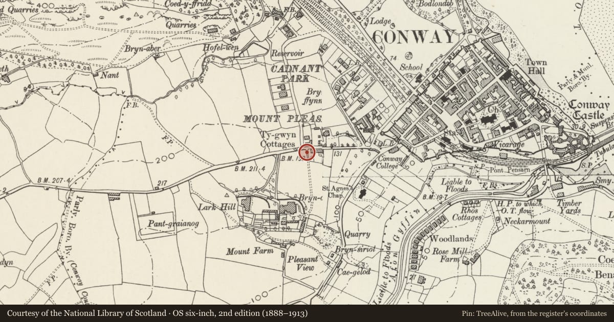
Slide toward Today to fade the historical sheet and see the modern map underneath.
David Rumsey Map Collection, Stanford LibrariesDavid Rumsey Map Collection, Stanford LibrariesDavid Rumsey Map Collection, Stanford LibrariesLlyfrgell Genedlaethol Cymru – The National Library of WalesDavid Rumsey Map Collection, Stanford Libraries
5 historical maps cover this location, the earliest the 1795 map "To Sir Watkin Williams-Wynn Bart ... the map of the six counties of North Wales is most humbly inscribed by his obedient humble servant" (Llyfrgell Genedlaethol Cymru – The National Library of Wales).
Historical maps covering this location
- 1795 · To Sir Watkin Williams-Wynn Bart ... the map of the six counties of North Wales is most… (Llyfrgell Genedlaethol Cymru – The National Library of Wales)
- 1830 · V.3:11-15:XV. Britisches Reich. A. Kon: England. b. Frstenthum Wales: Shire: 37-40 (David Rumsey Map Collection, Stanford Libraries)
- 1883 · Watershed map England, Wales 3. (David Rumsey Map Collection, Stanford Libraries)
- 1899 · 94 Beaumaris (Hills) (David Rumsey Map Collection, Stanford Libraries)
- 1901 · Sheet 9 and 10. (David Rumsey Map Collection, Stanford Libraries)
Cadw's description
Location
To the NE of Bryn Corach, opposite Muriau Cerrg on the corner with Cadnant Park.
History
Bryn Corach was built in the second half of the C19. The gate piers and walls to the back drive are shown on the 1889 Ordnance Survey.
Exterior
Round rubble-stone gate piers, the caps overgrown and partly missing. On the R side is a splayed section of wall incorporating a pointed arch with later boarded door. Inside the drive on the L side is a lower round pier to an iron gate. The drive has rubble-stone walls and at the S end are 2 more round gate piers, the caps overgrown and partly missing.
Reason for designation
Listed as piers and walls of definite C19 character, and for group value with Bryn Corach and its garden walls.
Nearby in the register
- Garden terrace walls and turrets on N and E sides of Bryn CorachNo class recordedunder 1 mi
- 1 Bryn FfynnonDomesticunder 1 mi
- 2 Bryn FfynnonNo class recordedunder 1 mi
- Bryn CorachDomesticunder 1 mi
Other entries of the same register within about three miles of this one, by straight line.