Cof Cymru: National Historic Assets of Wales · Wales
Pabo Lodge
Conwy, Conwy, Wales
A Grade II listed building in Esgryn, Conwy, designated on 8 October 1981.
The record
- Designation
- Listed building, Grade II
- Broad class
- Domestic
- Date of designation
- 8 October 1981
- Locality
- Esgryn
- Community
- Conwy
- Unitary authority
- Conwy
- Country
- Wales
- Coordinates
- 53.28827, -3.78500
- Cadw reference
- 3328
Slide toward Today to fade the historical sheet and see the modern map underneath.
David Rumsey Map Collection, Stanford LibrariesDavid Rumsey Map Collection, Stanford LibrariesLlyfrgell Genedlaethol Cymru – The National Library of WalesDavid Rumsey Map Collection, Stanford LibrariesNational Library of Scotland
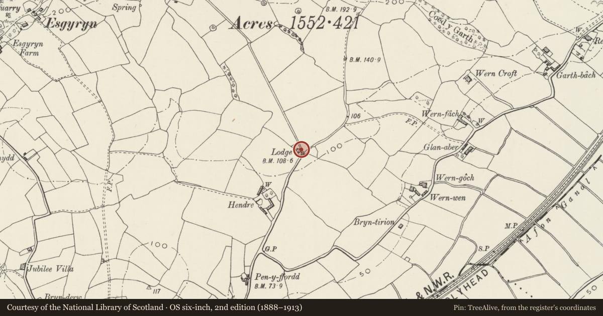
5 historical maps cover this location, the earliest the 1795 map "To Sir Watkin Williams-Wynn Bart ... the map of the six counties of North Wales is most humbly inscribed by his obedient humble servant" (Llyfrgell Genedlaethol Cymru – The National Library of Wales).
Historical maps covering this location
- 1795 · To Sir Watkin Williams-Wynn Bart ... the map of the six counties of North Wales is most… (Llyfrgell Genedlaethol Cymru – The National Library of Wales)
- 1830 · V.3:11-15:XV. Britisches Reich. A. Kon: England. b. Frstenthum Wales: Shire: 37-40 (David Rumsey Map Collection, Stanford Libraries)
- 1883 · Watershed map England, Wales 3. (David Rumsey Map Collection, Stanford Libraries)
- 1901 · Sheet 9 and 10. (David Rumsey Map Collection, Stanford Libraries)
- 1930 · OS Popular Edition 1919-1947 (National Library of Scotland)
Cadw's description
Location
A roadside lodge S of Pabo Hall, approximately 1.6km ENE of Llandudno Junction.
History
The lodge is parallel ranges of which the easternmost facing the road is earlier and is probably the building shown here on the 1845 Tithe map. The W range is first shown on the 1890 Ordnance Survey, and was subsequently extended. In its present form the lodge was a remodelling of the 1880s roughly contemporary with the rebuilding of Pabo Hall and outbuildings (dated 1885, 1886).
Exterior
A single-storey lodge comprising 2 parallel ranges, of rubble-stone with larger quoins, slate roof with moulded barge boards and small finials, and central rendered stack to the E range. The double-gabled S front has a central full-height vertical joint and quoins that indicate that the W range is later. Both ranges have windows with cusped lights under bracketed lean-to canopies, 3-light to the W range and 2-light to the E range. The entrance at the R end of the E range has a later half-glazed porch and half-glazed door with diamond-leaded glazing.
The R end wall facing the road has two 2-light windows similar to the front. The W range is longer and has a short E wall which has a half-glazed modern door and modern 2-light window to the R with cusped heads. The W side wall is white-painted render with inserted window and flat-roof projection at the rear.
Interior
Not inspected.
Reason for designation
Listed as a lodge retaining late C19 architectural character, and for group value with other listed items associated with Pabo Hall.
Nearby in the register
- Wern Wen FarmhouseDomesticunder 1 mi
- Wern Goch, including attached farm buildings to the rearDomesticunder 1 mi
- Brodnant FarmhouseDomesticunder 1 mi
- Archway at S entrance to former stable yard at Pabo HallDomesticunder 1 mi
Other entries of the same register within about three miles of this one, by straight line.